Saturday, 27 October 2018

ONE LAST LOOK AROUND TOWN - WARATAH - PART 5 (A BIT MORE HISTORY AND THE LAKE) (23 - 25 JANUARY 2018)

We had already wandered the western end of town. To complete our Waratah stay we took a stroll to the other end of Smith Street, and back again around the quite extensive lake system which is part of Waratah's charm.


St James Anglican Church was our first port of call, and here we discovered that this neat but relatively unremarkable little church building has a claim to fame. 


as detailed on the nearby information board.


Beyond this old church, which I have to say, given its age, is a credit to those who have maintained it, we came to the road junction where, on one side the owners of the Waratah Roadhouse makes much of the fact that this is 'tiger country'.


Apart from dispensing fuel, this establishment is the town take-away shop where this sign clearly indicates that they do not welcome those who dump and run! I did take the time to have a chat to the staff when I took this photo....a real sense of humour does prevail in this shop.


I mentioned in my first Waratah missive that to access our camp ground we had turned off the main street at the old mine manager's house.


Well, here it is, opposite the roadhouse. I must admit, were it not for the fact that it is included in the Waratah 'Town of Tin' walk, and does feature a couple of the signs which go with that, we probably would not have recognised it for what it was.


But reflecting on the photos we had seen of 'old Waratah', this was indeed 'the big house', and its location was clearly significant. And there can be no denying that good old Ferd had been a very busy boy, on and off duty!


That's it for the local history bit, so now we jump to the other end of town and our stroll around the lake


where this good walking track allowed us to do just that in comfort.

Let me pause here for a quick reminder of how this all works (and to have another play with my new toy.....the arrows on the photo). Red=the mine managers' house, yellow=the start of our walk,blue=the iron bridge and white=the last bridge we crossed to return to camp.


As you can see from this photo our short walk took us around the western end of the lake system where a metal cutout on the bank lets all and sundry know that another of Waratah's attractions is the chance to spot a platypus in the lake.


As we walked on towards the road on the southern side of the lake we were able to view the old iron bridge from a different angle, this time with the scared landscape of the Mount Bischoff mine site as a backdrop.


A public picnic shed


and kiddies' playground are features of the park on the southern side of the lake


and just beyond these we came to the pedestrian bridge 


from which we could view this rocky section of the connecting stream


and this lovely leafy lakeside area.


From here too we could see across to the road bridge


which I had crossed on my trip to Corinna a couple of days ago.


And with that we were had completed the circuit.


We weren't the only ones out and about. These geese had been our constant camp companions ever since our arrival, and when they took to honking I could easily understand why the Romans of ancient days used these birds as sentries.


And that, dear readers, completes my take on Waratah. What a wonderful stay this had been, and as I mentioned previously, we could not have been more pleased with our decision to make 'Tin Town' our Cradle Mountain jump off point.

On the morrow we were off to 'the big smoke', comparatively speaking. The Cruiser was due for a service. We had booked it in to the Toyota dealer in the north coast town of Burnie which was to become our next port of call.

ANOTHER DAY TRIP - WARATAH - PART 4 (CRADLE MOUNTAIN AND DOVE LAKE) (24 JANUARY 2018)

There was no respite for us during our Waratah stay. We had much to see and do, and today was earmarked for another of the ventures on every Tassie tourist's 'absolutely must do' list.....a visit to what is probably the most well known of all the Tasmanian high country destinations, Cradle Mountain.


I woke in a panic. We had grown used to the fact that here in Tasmania one just had to take what came weather wise, but today was different. We were about to visit one of the most scenic spots in the State. Today a clear and sunny day was paramount, and all I could see around us 


was a low lying fog. As usual, I had been responsible for making a weather prediction and picking the day. "Don't panic Lizzie, it's only a morning mist", he said with a hearty bravado which did not extend beyond the uttered words.


We had decided to take off very early for our 70 km trip across to Cradle Mountain for two reasons. Our research had told us that early birds can actually drive all the way through to the Dove Lake car park. But that has only a limited capacity, so those arriving later must park either at the Visitor Centre or a transfer station half way to the lake and hop on a shuttle bus. 

The second reason for our 'sparrow's' take off had everything to do with the tourist season.....it was peak time. We figured that if ever this iconic spot were to be hectic, now would be the time, and as you will see later, we had nailed this!


By the time we had reached the junction on the A10 at which a left turn would take us east across the mountains to our destination, things were still less than entirely promising, but the haze was showing signs of clearing.


This sign demanded a quick halt


to take in the views ahead across the ranges, one which did not fill me with great confidence as far as my predictions were concerned. 


But to my great relief, as we pushed on off the peak, things began to look much clearer. "Told you so, Elizabeth!"  "You're off the hook, but only just", was the less than charitable reply. 


To my abiding relief by the time we were on approach to the Cradle Mountain park area the sky was clear and the sun was bright. I was on the verge of a quick brag, but decided not to tempt fate.


The sign at the entrance to the Cradle Mountain Hotel is as flash as the destination it advertises. This and Peppers Mountain Lodge are the two high fliers here, with prices to match. 


Uh, oh! Our first glimpse of the fabled peak was not encouraging. I remained mute in the face of the somewhat frosty glance I got from the passenger's seat. 


We had no need to stop at the Visitor Centre to buy the required entry pass into the Cradle Mountain National Park. The 12 month pass affixed to our windscreen was our ticket in. 


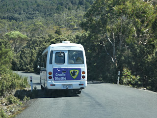
Now that we had passed the first potential choke point at the Visitor Centre, our next target was the car park designated here as 'Cradle Shuttle Bus Service (opposite number 4....Cradle Valley Boardwalk.). This is the point past which only those who arrive early enough are permitted to continue to Dove Lake in their own vehicles. Once that car park is full, a seat on the shuttle bus is the only option, and whilst they run continuously back and forth, we were not keen to have to wait around.


We had arrived in time. The road was still open to private vehicles so we pressed on rejoicing


up the ever narrowing access road, one so narrow that passing is only possible at designated layover areas. I'll have more to say about these and a clever ploy we adopted later. But at this time of the morning all traffic was heading up the hill,


and we arrived at the Dove Lake car park without incident. Mind you, despite what we calculated would be a sufficiently early start to reach this point, as you can see, we jagged the last remaining spot which was large enough to accommodate the Cruiser. And look what was in front of us!


I could not resist one first shot of what must be one of the most recognisable Tasmanian


scenes, if not Australia's, 


before we headed off for the walk around Dove Lake. And just look at the weather.....all had cleared out to become a fine sunny morning, and, importantly, there was no breeze to speak of as we set out.


"Well, are you coming or not?" As usual I was dragging the chain, shutter clicking. All the pathway signs advocate that this trail around the lake is tackled in a clockwise direction. We soon learnt that this does provide better views, but of course it was not too long before we ran into others who had decided to do their thing....the wrong way.


I did tarry briefly again as we reached the end of this first section of the trail, to look back towards the car park whence we had come,


before we hit the first short boardwalk stretch.


From this point on I shall let the photos do most of the talking. They do speak for themselves. The trail around the lake presents a combination of boardwalks, bridges and gravel paths, and, as you will see shortly, on the far side of the water, a quite challenging series of stairs, steps and inclines. Moderate fitness is suggested as a requirement for all who attempt this delightful stroll which should take between two and three hours.


Whilst much of the walkway cut through quite thick scrub in many places, there were also plenty of open spots from which to enjoy this iconic Tasmanian scene. I'll try not to go overboard!


Five minutes or so after we set out we came to this gate,


from which a set of rock steps took us to the top of Glacier Rock, our first lookout point.


This shot, which I took at the end of our tramp, shows where we were standing once we had reached the top of the short climb. 


Thankfully our early start meant that we had it to ourselves as we gazed across the lake to the distinctive twin peaks of Cradle Mountain,


and back over the section of the trail we had just walked,


from the car park which had been our starting point.


And across the water we could see another sights which features heavily in much of the tourist blurb....the Dove Lake boat shed on the far bank.


As we descended and rejoined the main trail, 


we could see bags of material of some sort lying on the edge of the track. This was a mystery at first, but then a few pennies started to drop.


A sound with which I am particularly familiar gave me the first clue, and as I stopped to look across to the hill line on the other side of the lake, another piece of the puzzle fell into place. These were bags of gravel which were spread on the track to create an (almost) even surface and to fill potholes. And in country like this, there is only one quick and efficient way to deliver them to many spots....by chopper.


With that puzzle solved, we pushed on. We still had quite a distance to go.


We soon found ourselves on a quite rocky section of track with thick bush either side,


but that soon gave way to a lengthy section of boardwalk, 


from which, at one spot, I was able to see out across the water to a couple who were viewing the lake and the surrounding mountains from an entirely different perspective. What a sensational morning for a paddle, particularly now that the early zephyr was dropping out.


Every so often side trails branched off the main track to provide access to lakeside 'beaches'.


Whilst these were anything but sandy, they did at least provide direct access to the water,


which was impossibly clear (and a tad nippy!)


After a short sojourn at the water's edge we pushed on


and on 


up hill and down dale, through ever changing lakeside scenery. A short distance along this elevated section of the boardwalk, 


I found a gap in the vegetation. Yes!


The breeze had died away completely. Another postcard scene unfolded before us.


The temptation to just sit and stare was great, but we had to keep moving, 


and in places like this the surrounding scenery was forgotten as remaining upright,


or not donging one's noggin on the overhang took priority.


We were no sooner through this tricky section than we were treated to more views through the trees


and over them


as we neared the southern end of this beautiful lake, now mirror calm.


And throughout all this, the fearsome jagged granite spires of 'the cradle' looked down on our every step.


What a picturesque place this is.


The track was now beginning to curve around the end of the lake,


and it was here that we came across another diversion, one which led to a resting bench,


which not surprisingly came with another charming lake view.


By now we were pushing past patches of much thicker scrub


and through sections where the trail was lined on either side with large tussocks of grass with fronds I would not go near. It was not the Cutting grass I had found near Corinna, but it did look as though it was a very close relative!


The colourful berries of the Pink Mountain Berry bush were a much more amenable track side vegetation, one which became more and more in evidence around this end of the lake. 


By now we had been tramping the trail for over an hour. It was time for a quick break, because from here


we could see what was ahead of us around the western side of the water.


What a change of scene this was as we sidled past this sheer rock face


squeezed under the overhang,


and climbed the stairs at the end of it.


This elevated position presented us with yet another different view of the mountain and the lake which was, by now, being ruffled by the ever increasing mid morning breeze. 


And then our surroundings changed dramatically, 


as the track took us through the grey gloom of the 'Ballroom Forest' and past the largest trees we had encountered thus far.


Once clear of the trees another 'beach' and yet another vista opened in front of us, but we did not tarry.


We had now reached the seriously challenging section of the track.


The morning was warming as we tramped down 


this relatively rough section of the trail, which as you can see from this shot was quite high above the lake.


By now our idle chatter had ceased. 


I, in particular, was focused on not breaking my neck or over challenging my bung knees.


As we took one last breather the cool wind off the water brought welcome relief. 


Another rocky descent now brought us to the only lakeside structure here at Dove Lake,


its famous boat shed. By now the crowds were flocking in. I had to wait for almost five minutes (and actually get a bit sharp with one group of Asian visitors) before I could finally get a clear shot. And for once, even Liz did not suggest I was lacking in patience!


With this last gentle descent our circuit was complete. It had taken us just on two and a half hours.


All that now remained was to navigate the ridiculously narrow road back to the Visitor Centre. And it was here that a spot of cunning and good intelligence proved to be a boon. We had already worked out that the drivers of the constant stream of shuttle buses were in continuous communication with each other to ensure that they passed at one of the layover points on the road. We calculated that if we tucked up right behind one of them, and kept our ears open on their CB channel, our trip would be much more easily completed.


So we did, and it was! 


The Mobile Marshies were feeling very smug indeed.


Liz insisted that we stop at Ronny Creek on the way back,


which is another pretty little spot.


Apart from its charm this is the point where several formal and informal walking trails begin.


Maps were being studied and decisions taken as we watched. 


One thing which draws many to this National Park are the many and varied walks on offer. In fact it is from this spot that the walking trail known as the Overland Track begins. For those fit enough and so inclined, this trail travels right across the Tasmanian high country, through the Cradle Mountain - Lake St Clair and Walls of Jerusalem National Parks. 

For those who are ill equipped for such a jaunt, guided tours are available. These come with all the requirements for overnight camping, food and water, etc, etc. And I have to venture that for just over $2,000 for what is a six day trek, that represents pretty good value, particularly given that those who do this hike see some of the most spectacular mountain scenery Tassie has to offer, including it highest peak, Mount Ossa. Another time.....perhaps!

After this quick stop-over we awaited the passage of another shuttle bus which we tailgated back to the Visitor Centre. 


What a sight greeted us there. It was, by now, almost midday, and what had been a virtually empty car park when we had driven past much earlier in the day was now a nightmare.


It was absolute bloody bedlam, in all directions. We ended up parking right at the end of this row before making our way back to the Centre


where crowds were queueing at the visitor pass desk (some with serious packs strapped to what must be strong backs)


and around the clothes and souvenir stands.


Liz was on a mission to find a postcard, and with that done, we were off. 


By now all available picnic areas were fully occupied, and the peak of Cradle Mountain was well in the distance.


Frankly, this is what we had hoped to avoid, and we did so with great success. We were out of here!


But as we departed rejoicing in the fact that our early start had paid such dividends, we had yet one more close encounter with nature, this time in the form of a Cradle Mountain echidna which was plodding its way across what was a very busy road at a speed which could virtually guarantee its imminent demise


So on went our hazard lights as I pulled up in the middle of the road in front of this beleaguered little monotreme and got out to assist. And no sooner had I done so than the damned ingrate stopped dead and curled into a defensive ball.  Right, smarty, what now? 


There was no way I was going to try to pick it up, so to the applause of the occupants of the now lengthy row of vehicles behind us, I gently prodded this terrified mass of spines towards the safety of the edge of the road. And what thanks did I get.....the little bugger peed all over my shoe!


What an ending to such a marvellous morning. As we made our way back to Waratah through more picturesque Tasmanian countryside, we were in complete agreement. This had been a touring red letter day. And to top it all off for yours truly, 'she of little praise' actually acknowldeged that I had gotten the weather right. I nearly ran off the road!


In my next brief missive we'll take a last look at Waratah before we pull up stumps and head off to the north coast.