Tuesday, 10 December 2013

BUSSELTON - PART 6 - MARGARET RIVER (DECEMBER 2013)

A disclaimer to begin this blog.....I have not taken photos of the vineyards and wineries of the Margaret River region (with two most notable exceptions) on the basis of the fact that I am sure all readers from SA will be only too familiar with those scenes....and for any other dedicated followers of these missives not so privileged in life...my apologies.  And for what it is worth, all of what we have seen in transit through the Margaret River area is so similar to the views through the wine regions of the Clare Valley as to be eerie.

Two major roads transit the countryside south of Busselton to Cape Leeuwin and Augusta, the Bussell Highway and the Caves Road.  The Bussell takes travellers directly through the Margaret River township to the southern coast, whilst the Caves Road, which lies to the west of the Bussell Highway, provides access to the coastal townships south of Cape Naturaliste including Yallingup, Gracetown (the scene of the dreadful fatal shark attack last week) and Prevelly.  Both routes provide direct and indirect access to the myriad of wineries of the Margaret River region, and also, in what was a real surprise for me, to a significant number of boutique breweries in which innovative brewmasters are concocting all manner of delightful tipples (The Bootleg's 'Raging Bull' dark ale is my choice to date...but I'm still working on others).

The Sandy Bay Holiday Village, some 6 kms west of the Busselton CBD and our former home at the Kookaburra, is now our base of operations.  Pressure of bookings at the Kookaburra park was the predominant driver of this change.  Although we miss the convenience of the Kookaburra's location, the Sandy Bay park, which is a mere 100 metres or so from the wonderful beach of Geographe Bay, has its own advantages, that being one of them.  


Let me take you on a quick tour of our new 'home' before we venture further afield.  The Sandy Bay Park is totally different from the Kookaburra.  The entranceway and office are unpretentious and there are relatively few caravan sites.


This is a park of cabins (sorry, in WA they are know as 'chalets' which we think sounds a bit pretentious, but there you are) At Sandy Bay most are made of pressed earth


but there are also others with a much more 'Swiss' flavour). Semi-permanent sites also abound with only a limited number of tourist caravan sites.  


We had first spotted this park when taking a constitutional along the coastal walkway during our stay at the Mandalay and decided then that it had promise. But we were also smart enough to make enquiries first hand before booking. There is only one decent site which is big enough to take our rig.  Site 90 was duly selected, booked and now occupied by the Mobile Marshies for our remaining fortnight in Busso.


Here our trusty C-Gear flooring has come into its own.  Sandy Bay is well named. The caravan sites are almost devoid of grass, 


but this is more than compensated for by the marvellous lawned area near the camp kitchen and amenities block, and there are plenty of trees to provide both shade and shelter from the ever present winds of WA...the incessant bloody winds of WA. We have now learnt that a still day here is an absolute bonus....it's amazing how one adapts!  Oh, and did I mention the flies?  Even the locals are complaining that this is the worst year for them they can remember.  Silly as it looks, I have taken to wearing a fly net over my hat and face when walking.


But it just wonderful to be able to pick up my rods and fishing bucket and take the mere two minute walk to the beach (that's the sea looking from the park entrance), 


where, despite the predation of squadrons of minnows of varying species, I have managed to catch a few good feeds of tommies (sorry again...herring!) and sand whiting.  I just love beach fishing (when there is a good reason to be doing it...namely catching something) and it doesn't come much better than Geographe Bay on a good day.  For balance, I must confess that I've had a few less than good days when it has been fish...squillions...Marshie ...nil....but in a venue like this I become very forgiving!

Enough of our current domestic bliss.  Off to Margaret River and places between here and there. We have already ventured a short way along the Caves Road to Yallingup, but I have decided to ignore chronology and present the various visits we made along this stretch as a separate blog when our exploration is complete.

'Cowaramup'....just try saying this quickly, or at all!  Liz and I have struggled with the pronunciation of this town name ever since we arrived in Busso.  Indeed a few of the locals have had a real chuckle at our expence listening to our mangled attempts, but I did feel vindicated when I later read on a sign in the town itself that, "As a slightly unusual and difficult name to pronounce, Cowaramup quickly became known as 'Cowtown'".

And indeed it is, but, in one of those really quirky Australiana tales which I just love, the formal name has nothing to do with our bovine companions.  It actually originates from the local aboriginal word 'cowara'...their name for a lorikeet...and the word 'up' which means 'place of'.  We were fooled for some time until properly educated.  (what continues to stagger us is the proliferation of the suffix 'up' in town names in WA...treat yourself to a glance at the atlas from Perth down to the south-west at some stage...it is incredible)

In Cowaramup the locals have exploited its coincidental (to its name that is) connection with all things bovine.


A walk across the old stone bridge in this lovely town park 


past this quaint Anglican Church nestled amongst the trees


takes one to the piece de resistance of Cowtown art......the colloquially known 'Rump on a Stump'. (note the more common of the heard grazing in the background)


What on earth is this all about is the obvious question, one which certainly exercised our minds. The answer lies in a mix of town history and very recent events.

Cowaramup was originally settled in the 1920's as part of the Government's 'Group Settlement Scheme'.  This entailed providing groups of families (usually ranging between 15-25) land grants for specific ventures.....in the case of Cowaramup it was dairying (and the coincidental connection between its name and its industry was born)

The demands of the local and interstate railway developments also saw the birth of a flourishing local timber industry.  Karri trees (the sharp amongst you will realize I misspelled this name in a previous blog....a rare admission of inaccuracy!) were felled for railway sleepers and other uses.  I was fascinated to read that many of the sleepers were exported to a number of overseas countries, carried as ballast in the sailing ships which transported them.  Some were actually used to refurbish the lines blown up by Laurence of Arabia, and karri blocks were laid in the streets of London's Piccadilly, Pall Mall and Regent Street.  To think, I've actually walked on them many years ago!

But, as we all know, trees like the karri take years to grow, and by the 1970's the local forests had all been felled which saw the demise of the timber industry.  However, all was not lost.  The ground cleared by the felling had been given over to other uses.....continuing dairying, beef, sheep and pig production and, of course, vineyards and a burgeoning wine industry.  Indeed, in our travels through this region we have noted with interest the highly productive hay paddocks and the herds and herds of dairy cattle in addition to the vines.

OK, so cows have been an integral part of Cowaramup's development....big deal...this is no different to many other country towns....so why the 'moo art'?

For many years Cow Parades have been staged all over the world in major cities...Paris, London, New York and Tokyo (of course you knew that...doesn't everyone?...I had certainly never heard of them before).  In any event, not to be outdone, some bright spark got the idea that the Margaret River region should join in.  So, in 2010, a hundred fibre glass cows were built and decorated by local artists before being auctioned off for charity. 

This was to be that.  Not so, said a couple of local Cowtown luminaries.  With the Rump on the Stump installed in the town park, 42 cows and calves were moved to Cowaramup, repainted as Friesians (the local dairy beast of choice) and dotted all through the township.


Everywhere!  Once again I had to exercise editorial restraint.  


The statues have all been sponsored by local industries or private individuals, 


and are tagged accordingly.


On our visit, the approach of the Festive Season was clearly evident.  As if the cows themselves were not enough, many were dressed for the occasion. Of them all this was by far our favourite.


And this play on words continued on the other side of the 'reindeer's' coat.


Never let it be said that the citizens of 'Cowtown' let any opportunity slip.  They exploit the theme to its fullest and, from what we saw, with great wit.


We decided that Cowaramup is a town in which we would get on famously with the locals but we didn't have time to find the pub.


Margaret River, I am sure, is synonymous to you all with fine wine and all that goes with it. Yet, unlike many of the SA wine regions, the development of this industry in the Margaret River area is relatively recent.  


And yes, there actually is a 'Margaret River' (here looking upstream from a foot bridge)


As stated in one of the tourist information booklets we seem to collect in droves, "in the late 1960's when Dr John Gladstone proclaimed Margaret River a viticultural paradise... the region underwent a profound change. Within two years vines were planted at Vasse Felix and by the early 1970's other pioneering wine producers such as Moss Wood, Cullen and Cape Mentelle emerged.  Over the last few decades viticulture has transformed the landscape and brought significant wealth to the area. It is now the main industry and an enormous source of pride from the community." 

Prior to this development and its extraordinary expansion, Margaret River, beyond its early agricultural and timber industry days, was a haven for surfies and artisans of varying degrees of skill and social grace.....almost a western version of early Byron Bay I suspect.  As we later discovered, the area does hold a good surf break. The remnants are still evident where those sporting dreadlocks and flowing clothes rub shoulders with the wine makers, the farmers, the earnest seekers after vinous excellence and the inevitable globs of over dressed and over loud Gen Y's and the faux rich who sadly infest all such areas as this, loudly braying their lack of any real knowledge for all to hear (and cringe away from).  You know the type!


One thing the tourist blurb doesn't mention about Margaret River is the marron.....the biggest marron on earth I am sure.   Liz was the first to spot them. She couldn't believe the size and neither could I.  I tried desperately to get a photo of this monster with a nearby swimming duck to provide perspective, but neither would oblige.  Suffice it to say we conservatively estimated this chap's length at 30+cms.  Some yabby!  And it was not alone.


As you could imagine, my mind turned immediately to capture and to the obvious question as to how these fellows could have survived here.  A nearby sign soon caught my attention and all became clear.  You can buy a lot of marron for $5,000.


The river lies in the valley at the northern edge of the township.  A well maintained park with BBQ's, a playground, toilets and an information bay greets visitors coming in on the Bussell, 


where a relic of Margaret River's past is also on display. 'Kate', this tiny steam locomotive which looks almost like an overgrown kids' toy, arrived in Margaret River in 1890, where, for the next 20 years it was used to haul logs. In 1917 it was taken to Wyndham where it continued to puff along until retired in 1950.  It now stands as a memorial to those many folk who laboured in the timber industry in Margaret River's development years. 


So, on to the township itself.  We wandered south out of the river valley into the main street where the first impressive building of some obvious antiquity we came across is now a very fancy Italian restaurant and guest house. We were surprised to read on a sign at the front of the building that it actually began life as a coach staging house run by the Higgins family who arrive in Augusta from England in 1830.


Just beyond this point we came to what is the beginning of the main street which climbs off to the south from this somewhat imposing pizzeria, 'Goodfellas'. I suppose the owners fancied the play on words in their choice of a name, but why anyone would want to choose the colloquial name for an American Mafia mobster for a restaurant is beyond me. (mind you, Liz had never heard of it)


The streetscape of the main drag in Margaret River was, for both of us, a little nondescript, with one exception, the Margaret River Hotel.


The photo does not do real justice to this grand hotel, which extends further along the street and for almost a block to the rear.  This is what we had expected to find, but that was it.
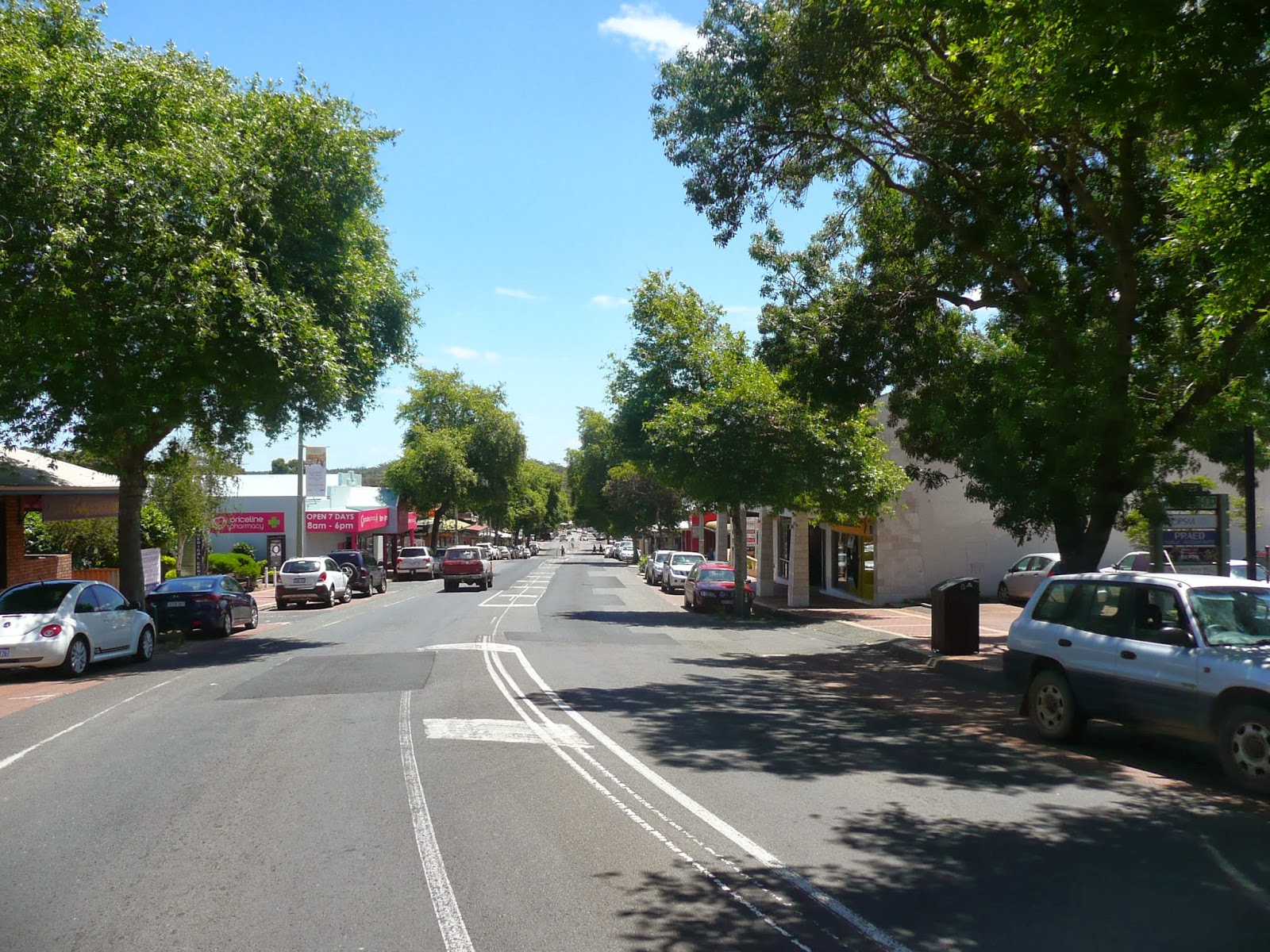

We continued our ramble to the southern end of the main street past cafes, clothing stores, restaurants of varying styles, wine and bottle shops and just about all one would expect to find on the main street in a tourist driven town.  I am not sure what either of us anticipated, but I have to say Margaret River itself was, for us, something of a non-event. I should add that this is an observation rather than a criticism.  We were to later learn that the flash B&B's and the up-market wineries and so on are all in the surrounding countryside. (more of that later)


And now a small indulgence in one of my favourite tourist pastimes.....clever signs. Here the good business folk of MR did not disappoint. The first of many I spotted was in the very well laid out (and very commercial...what would you expect?) information centre.


The next to attract my attention was in the front window of the shoe store.  I need a new pair of boat shoes...and these were my preferred brand.  I was nearly hooked!


And finally, words of complete wisdom on a nearby cafe. As I took this shot, the employee who actually inscribes these witticisms on the front window was sitting nearby eating his lunch.  He was tickled to discover that his wit (well, probably his plagiarism being more to the point) was appreciated even if we did not indulge in what was on offer inside.


The southern end of the main street ends in one of Margaret River's numerous small and pleasant parks.  From here we retraced our steps and called it a tourism day.  


Another part of the Margaret River area jigsaw was in place.  All that now remains is the Caves Road, the towns of the south-western coast and Cape Leeuwin, where the Southern and Indian Oceans meet.

Wednesday, 4 December 2013

BUSSELTON - PART 5 - THE TOWN (NOVEMBER 2013)

The attraction of the Busselton jetty and foreshore precinct is obvious, but for us its other charm lies in the fact that most of the streets of the CBD are tree lined and leafy and park areas abound. The CBD itself is home to all manner of shops whilst a very comprehensive range of commercial services can be found in the industrial area which is close to the main shopping section of town, but distinctly separated from it.  

We strongly suspect that the plethora of goods and services available in Busso (including two large Woolies... one of which is the largest we have ever seen.....a mere 500 metres apart would you believe) is a direct result of the recent and continuing population explosion. According to the latest relevant statistics, today's Busselton is not only the fastest growing population centre in WA, but it leads Australia. 


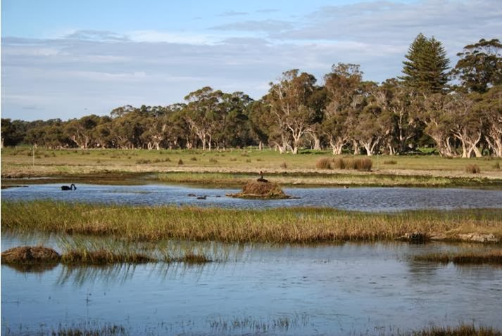
Let's have a quick look around the town, starting at the southern end of the main CBD where the Vasse River lies as an extremity of the Vasse-Wonnerup Estuary and wetland about which I have previously written but did not photograph too well.  Hopefully these two 'borrowed' shots


give a better idea of the extent of the waterways which lie to the west and north of Busselton. 


In fact water, both saline and fresh, is an ever present feature of the town.  Greater Busselton is 15 kms long by 1 kms wide, built on the narrow strip of suitable land which lies between the sea and the marshy ground of the nearby wetlands.  As a quick aside, I was interested to note that a series of swamp drainage channels have been dug in this region just as has been done in SA's south-east. 

The towns origin's date back to the Bussell family (surprise, surprise!) who moved to this area from Augusta in 1832 and took up land which they built into one of the young colony's most productive cattle properties, 'Cattle Chosen'.  A site at Wonnerup, just east of the present town, was originally selected for settlement, but, as the previous photos of the marshy wetlands show, this was clearly unsuitable for such a project and the wiser head of the colony's Surveyor General, John Septimus Roe prevailed in determining that Busselton would be established where it now stands.  

In addition to the burgeoning cattle industry, (the dairy industry is still very strong in this area) the dense local forests provided for a thriving timber felling industry.  I am sure all would associate the south-west of WA with both Jarrah and Kauri forests, but in the Busso area it was the equally valuable eucalypt, the Tuart, which sustained the timber industry for many years.


These hardwood trees grow to over 30 metres.  The light colour of the timber, very similar to Honey Oak, coupled with its fine grain, saw it become highly prized for the manufacture of quality furniture.  Tuart timber was similarly valued by the building industry because of its density and durability.  The demand for this timber, and the added pressure to clear land for grazing in the Busselton area, resulted in the decimation of the Tuart forests to the point that now a mere 2,000 hectares of old forest remain.   The Ludlow Forest (pictured), a few kms from Busselton, is now one of the rarest forests in the world.  Major attempts to manage and expand the forest are now underway.  In an odd twist of nature, one of the serious impediments to its rejuvenation is the fact that the Western Grey kangaroo, the population of which is expanding in this area, just loves munching on young Tuart saplings.  What a conservation dilemma! 

But back to the town.  On the banks of the Vasse at the southern extremity of the main street we find Breeden Park.


Whilst the still, almost stagnant and very dark waters of the Vasse (it really only flows when wetland channel gates are opened to release water after heavy rain) do not present as the most attractive waterway, its attendant parks make up for that in a major way.  


Green, shady and well maintained, Breeden Park is also home to some interesting art work, not the least of which is the 'Vasse statute'.


A closer look at the rather naive figure of Vasse himself shows him depicted with a 'broken heart', literally.  And herein lies an interesting tale.  Thomas Timothy Vasse was a Midshipman with the Baudin expedition.  In June of 1801 Baudin's corvettes, the Geographe and the Naturaliste, were at anchor in Geographe Bay when, in threatening weather, a party of the expedition's scientific members went ashore to explore the area.  The weather continued to deteriorate over the following two days until, by June 8, a howling northerly gale was lashing the Bay.


In heavy and dangerous surf, the shore party were eventually hauled off the beach on ropes attached to longboats lying outside the surf line.  Vasse did not make it.  He was swept away by the powerful waves and shore currents and never seen again by Baudin or his crews.  

This much of Vasse's story is relatively unchallenged, but beyond his actual disappearance, things become interesting.  Local legend has it that he actually survived his watery ordeal and was given succour by the local aboriginal tribe, only to live out his days wandering the shore forever searching the horizon for any sign of a rescuing sail. (other accounts have him making his way back to Europe on an American whaler...but this version of his life has been roundly discounted by all even vaguely qualified to do so).  

Whatever the real outcome of Vasse's disappearance, he is now depicted in Breeden Park, both in his statue and the inscription on the boat shaped board in front of him as having 'died of a broken heart' in the strange land of the antipodes.  What a yarn!  And I have to say that, having lived through two days here in Busso during a recent northerly buster, the normally benign waters of Geographe Bay do become bloody angry indeed.  I can well understand why the visiting French were in strife attempting to regain their ships.


Enough history...back to today and the parks of Bussellton.  To the west of Breeden Park, across Causeway Road, one can stroll further along the Vasse on a linear park which extends


past the Shire Offices for just under a kilometre towards the industrial area.


Whilst a large number of impressive gums are flourishing,


many of the Flooded Gums on the rive banks itself have fallen victim to the predation of insects, (lerps, leaf minors and gall beetles to be precise!).  Much is now being done along this park to encourage the return of bird species which keep these insect nasties under control.  We wish them well in their endeavours.


Returning to the CBD, we find the charming Anglican Church.  Built in 1845, the sign at its entrance proudly proclaims it as the oldest stone building in WA.


Opposite the church and its own delightful garden surrounds, is yet another park area


which is home to the Busselton Memorial gardens and monument to the fallen.


Continuing our wander north along the main street, we come to Albies, one of the largest of Busso's four main pubs.


From here I took in the view north along Queen Street, the main drag, to the not too distant esplanade.  As you can see, the one drawback of this street is that it is very narrow, and, unlike this early Sunday morning shot, is usually crowded with traffic moving through at a snail's pace when the CBD becomes 'bustling Busso'.


Many of the streets which run off Queen Street are much wider, and trees abound.


It was down such a street we came across one of the most innovative re-uses of an old building I have ever seen. Rather than knocking it down in a redevelopment of the street, this original Chapel has been retained as a cafe by building around it,


as can be seen when viewed from inside the arcade in which its interior  is located. (the rather ethereal glow at the top of the shot is actually light pouring in through the windows built over the original gable....and I have actually adjusted contrast!)


The obviously named 'Fig Tree Lane', which is entered through the arch in mid shot,


is another of Busso's delightful commercial nooks and crannies which provided an interesting method of walking between two streets.


Briefly back to the town's parks...Mitchell Park, which graces the intersection of Queen Street and Prince Street, provides yet another tract of open space in the CBD. 


and in one final salute to the 'greening of Busselton', a view down Prince Street itself at a spot just opposite the Post Office (where we did spend a bit of time over the past week or so).


On the final leg of our stroll north along Queen Street towards the jetty and our caravan park, we pass the impressive facade of the Vasse Hotel building, which, whilst still housing a bar is


now home to a very well patronised corner cafe and other commercial ventures.  


Within the next block we wander by the Busselton Court House and Police station, just around the corner from the Kookaburra park (comforting) as we complete our whistle-stop toddle around the Busselton CBD.


And now we are on the move again after three weeks in the Kookaburra...about 8 kms to the west of the CBD to the Sandy Bay Holiday Park, a stone's throw from the shores of Geographe Bay. This will be our base for exploring this part of the south-west for the next two weeks.  We have already made a couple of sorties into the Margaret River area and beyond, and north to Bunbury, but still have much to see....and there a many more fish to be caught!


Sunday, 1 December 2013

BUSSELTON - PART 4 - THE FORESHORE (NOVEMBER 2013)

After being here in Busselton for three weeks now, it is time to have a look at this town which has consistently been voted as one of WA's best holiday destinations.  Judging by the number of 'locals' who have been our neighbours here at the Kookaburra (from Mandurah, Perth and points in between), and the fact that the park is booked out entirely from about now to the end of March, these accolades seem well placed.

I suspect that there is hardly anyone who has ever contemplated travel in WA who would be unaware that the main feature of Busselton is its jetty, its enormous jetty....all 1,841 metres of it.


The jetty precinct is the hub of 'tourist' Busso.  The swimming enclosure (open to the sea), the white, fine sand beaches, the parks, BBQ's, restaurants and other facilities are all magnets to visitors and locals alike.  

But the jewel in this crown is certainly the jetty.  What is its story?  Why is it the longest wooden pile jetty in the Southern Hemisphere?

Timber felling was one of the first local industries, both here and further south between the capes (Cape Naturaliste and Cape Leeuwin....'cape to cape' is a common local phrase).  To export this cut timber by sea, the most efficient method of transport out of this area, docking facilities were obviously needed.  Additionally, the many whaling ships which also roamed the seas off this part of the WA coast (apart from the established centre at Albany) were also in need of a wharf.

In 1865, construction began on the first section of the Busso jetty, a mere 161 metres.  By 1875, the encroaching sands of the already shallow Geographe Bay demanded an extension, and another 131 metres were added.  This process continued over the years until, by the 1960's, the jetty had reached its  current mammoth length.

The Busselton jetty was fully operational until the last ship tied up on 17 October 1971.  By this time the nearby expanding, and much more efficient, Port of Bunbury had reduced the use of the Busso facility to a trickle of ships. The Government formally decommissioned the jetty, and, of course, took no more responsibility for its upkeep.  By this time over 5,000 ships had made use of it.

As could be expected, the jetty subsequently began to deteriorate.  Borers, wood rot and fire all took their toll.  As if this were not enough, on 2 April 1978, Cyclone Alby, one of the very few to sweep the coast this far south of the tropics, destroyed much of the shore end of the jetty.  Its fate seemed all but sealed....demolition loomed large.

The prospect of the complete demise of this incredible structure galvanised the good burghers and citizens of Busso into action.  Over the years that followed an initial sum of $9 million was raised and spent on jetty restoration.  But its woes were far from over.  In December 1999 a fire destroyed 65 metres of the structure.  A further $900,000 was spent to rectify the damage.

The tourist value of the jetty was now well recognised and in 2011 a $27 million refurbishment was completed.  Of this the WA Government pitched in $24M whilst the remainder was provided by the Busselton Shire and the newly formed Busselton Jetty Environment and Conservation Association. The work carried out included the construction of the 'Beach Hut' Interpretive Centre at the shore end of the jetty (by now probably one of the 'iconic' Busso landmarks) and an underwater viewing facility at the seaward end.  

These days the use of the jetty is entirely recreational.  One does not visit Busso without walking its length at least once.  Many locals actually use it as their daily walking track.  And it is a mecca for those wishing to add fish and squid to their larders (although to date I have done much better off the beach...more of that later).  

I have to confess to having been highly peeved when we first attempted to stroll its length.  We found our way barred by a set of entrance gates.  What is this, we asked.  All soon became clear....between the hours of 0830 and 1800, when the office of the Interpretative Centre is staffed, an entry fee of $2.50 per person is required.  Pay to walk on a jetty!!  I was outraged. My ire was cooled somewhat when I discovered that the jetty's current upkeep is highly dependent on these funds, together with those raised by the fares paid by passengers on the small jetty train, and the visitors to the underwater viewing facility.  Mind you, all of us 'in the know' go for a constitutional gallop or set up a fishing station outside those hours!  


Apart from all the uses to which we mortals put this edifice, the local silver gulls have not been slow off the mark either.  I was fascinated to see that they use portions of the old jetty structure 


as safe nesting sites.  Certainly seems a much safer option than hollows on an open beach or sand hill. 


At the shore end of the jetty stands the Busso Information Centre, housed in what I at first took to be an old lighthouse building, which is exactly what I was supposed to think.  In fact it is 


nothing of the sort.  It is neither old nor functional from a seafaring viewpoint.  This tower, which was built in the mid 1990's, originally housed Busselton's first water slide.  It has now been converted to its current use, but may not have much of a future.  I discovered when investigating the origins of this building, that it, and much of the surrounding foreshore area, have been sold to a developer.  His plans are not yet well known and many locals are understandably nervous.  

Whilst on that mission, I decided to fork out yet another fee ($2.00 this time) to climb the stairs to the observation platform atop the building.  It was worth it.  Other than by doing this, it is virtually impossible to capture the entire length of the jetty in one shot or to be able to take in the panoramic views on offer from this eerie.
.


From here the Esplanade park areas can be seen stretching some distance to the west of the jetty.


We were particularly impressed by the standard of maintenance of these parks where the well manicured lawns and great BBQ facilities can be used by all.


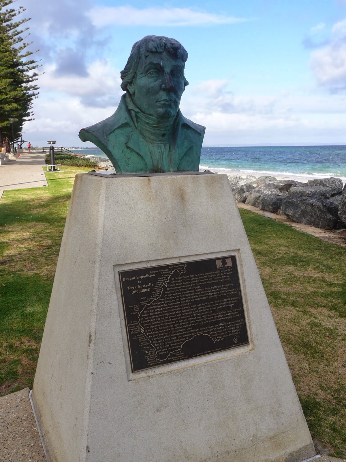
This seafront park, which is just one of many which abound in Busselton, is home to a small bust and plaque detailing the exploits of Nicholas Baudin and the part he played in opening the western coast of Australia to the world.


I have included this close-up of the plaque merely to show the extent to which Baudin charted the Australian coastline...almost half its entire length.  His attention to detail certainly matched that of the much more well known (to us, that is) Matthew Flinders. 


Twenty three scientists accompanied Baudin in his two ships. Their disciplines included astronomy, zoology, botany, horticulture, mineralogy and geography. The numbers of specimens of flora and fauna his expedition collected and returned to France would rival that of Sir Joseph Banks of Captain Cook's much earlier exploration of the east coast.  It struck me as a great shame that Baudin did not live to receive the accolades he richly deserved from his home country of France, and indeed the world at large.  He unfortunately died of tuberculosis in Mauritius whilst homeward bound.  He was only 49 years of age....a life far too short for a man of such impressive talent and courage.


But back to the present and the jetty precinct. The 'Beach Huts' housing the Busselton jetty Interpretative Centre are probably one of the town's most recognised features.  Beyond them,


at the shore end of the jetty stands 'The Goose', the most up-market of the foreshore restaurants. Its gabled structure and colour scheme cleverly match the jetty huts design but as to its interior, I cannot comment.  Liz managed to take a peek at the drinks and food menu as we walked past on one occasion.  For what a good night out at The Goose would cost us we could fuel the cruiser for 500 kms!  Our dining out sights were very much lowered.  The local MSG free Chinese restaurant was just the ticket!

Opposite the esplanade parks, looking over the roof of The Goose, the fine Busselton town beach continues away to the east along Geographe Bay.


The stubby jetty is used to load a flat bottomed barge like boat used for jetty maintenance, and, to the right of the shot some of the foreshore playing fields come into view.  These are extensive, and whilst we were in residence, were being expanded considerably.  In fact, in the course of two weeks, a bare earth area the size of at least two normal ovals was laid with new turf.


To the south of the tower, the view takes in the beautifully kept expanse of lawn tennis courts, a small section of the extensive parking area and the roofs of the Busselton CBD, and, panning slightly further to the east,


we look across more expanses of the car parks to Marine Street which lies directly behind the large green Council depot shed a the right of the shot.  The front of the Kookaburra Caravan Park abuts Marine Street which hopefully provides some idea of just how close we were to the jetty and beach.


One thing which surprised me, given the extent of the local beaches and the degree to which they are used, was the absence of a large and thriving Surf Club (notwithstanding the fact that Busso is a flat water beach like Glenelg).  At this stage the infrastructure provided to the local 'seals' is basic to say the least. These shipping containers, standing next to the Sea Scouts building, are the current Busselton SLSC clubrooms.  A much more fitting building is in the offing as part of the redevelopment of this part of the foreshore, according to one of the Clubbies to whom I chatted whilst fishing on the beach.


And whilst on the subject of fishing....this is a pastime much practised in Busselton, primarily from the jetty (not surprisingly) where I was impressed to find a number of these fish cleaning stations dotted along its length. My limited efforts from this venue were unsuccessful as far at hooking anything edible was concerned (I was amazed to see some of our Asian friends actually targeting Trumpeters...known to me since childhood as 'shitties' for a very good reason...they taste revolting and are full of bones) 

but the beach near the stubby jetty did prove more productive on one of three occasions the weather made for ideal conditions on the beach.....and it was just great fun.


The picture of this foray was not that from which I returned with fish.  That had occurred a few days previously, and of course, as is always the case, we return to the scene of the crime with high expectations.  But as they say, "the worst day's fishing is better than the best day in the office"...only problem with that is that this is my office now!

What could be more tasty than a feed of fresh tommies?  Wash my mouth out...they are 'herring' over here.  In fact the bureaucratic powers that be have declared that all fish will be commonly named throughout the country and we should be calling these fish herring now in SA, but for me they will always be tommy ruff.  


Whatever the nomenclature, they were a great feed, grilled that evening on the Baby Q, 


after being faultlessly filleted, that is! (no idle boast, by the way....the co-pilot is paranoid about fish bones)


I remain greatly hopeful that the beach to which we are soon to move will be as productive as I have been told it is.

Apart from the Norfolk pines and grass, which did bring a touch of 'Glenelg wistfulness' to our wanderings, there was another reminder of home on the foreshore.  The sound of a helicopter will always attract my attention, but to see a Westpac surf chopper making forays to and from the shore not too far from our park was altogether too much. "They're doing training jumps", I proclaimed.  It is amazing how derisive "how would you know...this isn't  Adelaide" can sound, but she managed!

All the incentive necessary had been provided....I was off.  And I was right.


As I pulled into the car park down the coast, I saw a body splash into the water off shore and, 


a few minutes later, the aircraft make a landing in a paddock abutting the beachfront roadway.  I made myself know to the group watching on and had the pleasure of meeting Peter Scott whose role is the equivalent of many I have had in SA.  We had a great yarn which culminated in an invitation to visit their hangar in Perth whenever convenient.  I shall certainly do so. What have I said previously about the smell of jet fuel?


The foreshore area will be coming alive in no small way on Sunday next, 8 December, when the town hosts a round of the prestigious International Ironman (triathlon) completion.  The event, which is owned and run by the World Triathlon Corporation, is in its 10th year in Busselton.  The expected 1,600 competitors will swim around the jetty (3.8 kms) before embarking on a 180.2 kms bike ride and, as if that were not enough, the sheep will be separated from the goats with a final full marathon along the beach front, a mere 42.2 kms. Good luck boys and girls.  Liz and I have already planned to make a day of it in Busso central on 8 December and, in the case of your intrepid correspondent, dream of days gone by! (if we are not cavorting with Perth friends in Margaret River, that is....decisions, decisions...life is such a challenge) 

Next, a look around Busselton CBD which we have decided must be the 'town parks' capital of the south-west.