"Arthur River is Tasmania's westernmost settlement. It is a town known
for its fishing and, when the winds are up (which they are most of the
time), for its huge waves and icy isolation....."
So says my old reference friend 'Aussie Towns', and as we were about to discover, the small settlement of Arthur River is certainly isolated, although, in my view, perhaps not quite to the degree that Corinna is.
Before we head off to 'the wilds', let me begin with this map, one which not only shows where we were heading and provides a reference to all the other towns we had recently visited in the west, but also highlights a Tasmanian feature which I have only mentioned in passing to date.
The Tarkine, a huge tract of pristine forest through which the dirt road between Arthur River and Corinna runs, is being touted as Tassie's up and coming wilderness area, one to match Cradle Mountain and the like. I doubt that it will ever achieve that status, but with improving access roads there is certainly a solid push under way to encourage more to tramp through this incredible patch of cool climate rain forest.

This map also clearly demonstrates that the claim made that Arthur River is the most western town on the island is indeed true (for whatever that may be worth!) Mind you, it only beats tiny Temma by a whisker.

As we set out south-west of Smithton, we were soon reminded that we were well and truly in cattle country, where some big brown bovines were grazing on dry looking grass

whilst other paddocks presented a much greener hue.

And then we had a reminder of another major industry of this area as a large timber truck thundered by. Believe me when I say, these blokes 'do not take prisoners on the highway'....it's get out of the way or get badly beaten up, something which was much easier to manage without 'the brick' behind us.

For a few short stretches tall timber bordered the blacktop,

but for the majority of the journey of 70 kms or so, we were traversing relatively open grazing land,

where stacks of the brightly wrapped hay bales sere a common sight.

A last gentle climb (with yet another row of bales in the paddock)

brought us up to the road junction where this was but the first of a plethora of road signs to confront road users here.

As we breasted the rise, this was what we saw, and no sooner had we turned left to head off to Arthur River

than we passed another stand of signs detailing the ferry access at Corinna, just over 120 kms south. I was actually very impressed by the fact that this information was presented so boldly at this point on the road, because it can be a long way from anywhere if the Pieman River cannot be crossed on arrival in Corinna (as I had discovered some days before).

We did not have to take any of this into consideration today. We were less than 15 kms from our destination, now travelling south along the coast road where tall trees and open grazing paddocks had given way to low, scrubby coastal sedge

and the odd stand of gnarled, weather beaten trees.

This section of the trip was across mostly only gently undulating terrain,

until we had almost reached Arthur River and began the descent into the valley along which the Arthur River flowed. Despite the rather ominous looking cloud bank out to sea, we were enjoying an unusually clear (and for this part of the coast a relatively calm) day.

Here we were greeted by the now familiar Circular Head town sign, one which had obviously seen slightly better days.

As we made our way past the small town general store and down towards the bridge over the river, it became immediately obvious that many of the homes here have been built to take advantage of the views, and why not?

We were a little surprised by the number of them, set on the slopes either side of the magnificent river from which the town takes its name.

The approach onto the bridge gave us a vantage point from which we could look down on the town dock. It is from here that visitors can board the cruise boat which plies this waterway. We had given this some consideration, but decided that our trip up and down the Gordon River was enough.
However, by the time we had left this area, a stay at the Arthur River caravan park had been included on our 'to do list' for any return visit. This would, I am sure, include a jaunt on the river.

But for today, all we did was cross it.
We were off to the 'Edge of the World', but before we get there let me present an aerial shot of the town and the river mouth, courtesy of 'touring tasmania'. We were about to make

our way out along the dirt track seen here on the right of the photo. And as this shot shows, the seas do pound in here with a will, and there is a very good reason for this as I shall explain shortly.

Once past the houses of the southern side of town,
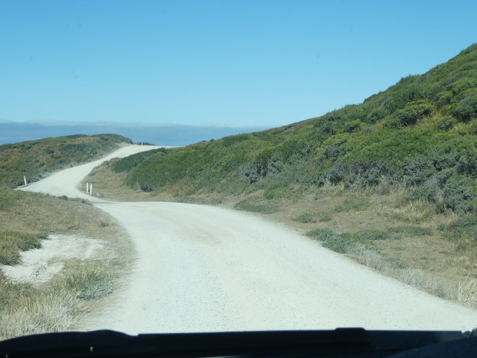
we soon found the track which wound its way to the

car park at Gardiner Point.

From here a short hoof up the well constructed walkway took us to the lookout on the low ridge

where this nearby small and very weathered plaque (courtesy of 'Aussie Towns') announced that we were now standing at 'The Edge of the World'. Why is this so?
Again let me acknowledge, the excellence of 'Aussie Towns' or at least their script writer for the following:
"Gardiner Point, which lies to the south of Arthur River, has called
itself The Edge of the World because, apart from its isolation, it is
further south than Cape Agulus (the southernmost point of Africa) and
therefore the waves breaking on the shore have come uninterrupted all
the way across the Great Southern Ocean from Argentina.........The view up and down the
coast is low, but impressive."
Now you can better understand why, when the winds of the 'Roaring Forties' are screaming east towards Tasmania, the 'fetch', from here to Argentina, allows for the build up of some tremendous waves. Today was not one of those days, but this did not mean the sea was flat by any means.

The views were impressive, south along the coast

and in the opposite direction, over the boardwalk and the stream flow of the Arthur River as it emptied into the sea.

Apart from the rugged beauty of this place, the evidence that the waves which crash onto the shore here have travelled thousands of miles across open ocean was all about us......driftwood was piled on shore

and high on the rocks in every direction.

There was masses of the stuff
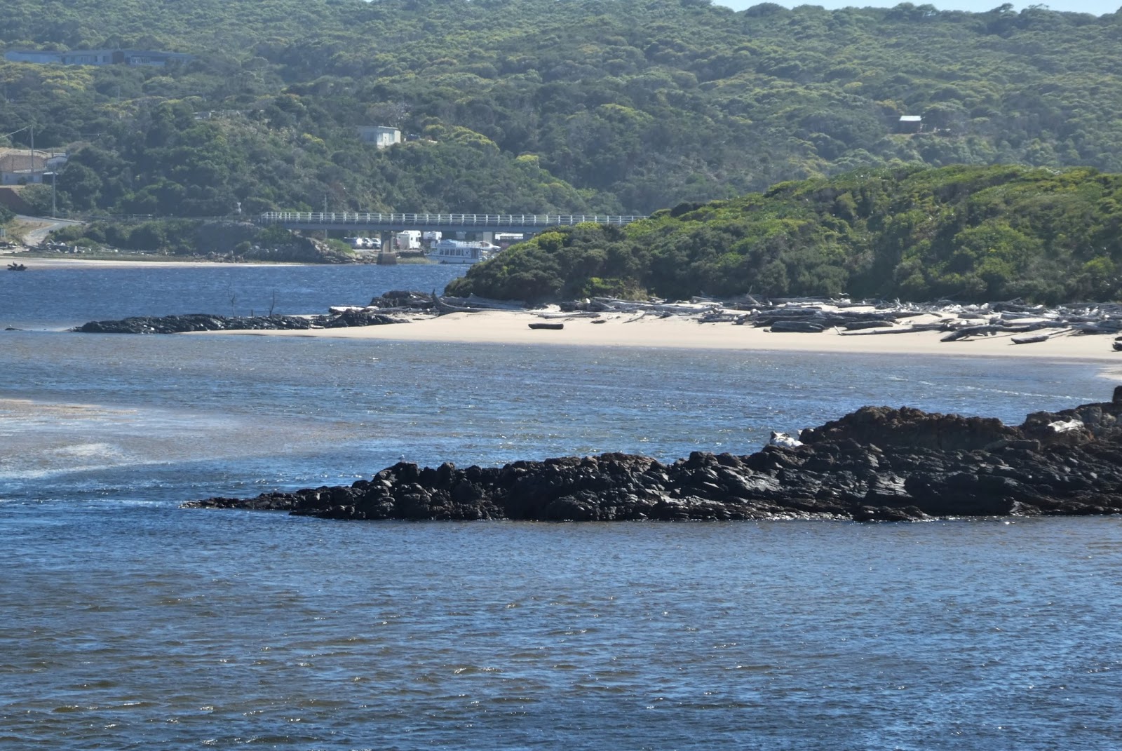
even along the beaches well up the river estuary.
One thing which did strike me, apart from contemplating just how much driftwood is actually floating around in the ocean, was the fact that this area of the Tasmanian coast is a real playground for surfers, particularly on the beaches a little north of Arthur River (two of which we'll visit on the way back). I could not help wondering how often some hapless rider of the waves has had an unwelcome encounter with another floating object sharing the same surf with far less control.

I must admit we did spend quite some time looking out over the restless seas and the rush of fresh water from the river before making our way back across the narrow river bridge,

and into the northern side of town,

where the road curved sharply and climbed quite steeply past these splendid homes perched high on the overlooking ridge. We did wonder if these belonged to some of the mere twenty five or so permanent residents, or whether they were the grand holiday homes of well off local graziers. Short of a return visit we'll never know!

As we retraced our steps northwards along the C 214 we were interested to see (but not photograph!) numerous roadside signs which indicated sections of the highway where speed restrictions were in place....to ensure that any of the many Tasmanian Devils which make this part of the island their homes, can cross in safety!

Before reaching the junction at which we had previously turned off the Bass Highway to make our way south to Arthur River, this sign presented us with an irresistible invitation.

We love poking our noses around back roads, and in this case we were well rewarded as we eased off on the throttle and meandered down towards the coast again.

The quite steep slopes presented us with spectacular views of the west Tasmanian coast

and the rich grazing lands which make up much of this area.

A final short stretch of gravel

brought us down to the rather barren car park at Nettley Bay, where strangely enough we were the only visitors. The shoreline here was mainly rocky, and we later discovered that this is not a favoured spot for general beach-goers, but does attract surfers when conditions are right.
The surrounding countryside was just delightful, and despite the lack of bay side sand, we had no regrets about having made this detour.

Back to the main highway....this time straight on past the junction to check out the small farming town of Marrawah where we soon discovered there was little to see other than another of country Tasmania's houses of worship, this time the rather plain looking Marrawah Gospel Chapel,

and the much more impressive looking local tavern. There was a bit more to the town than this, but my on-board photographer had an uncharacteristic lapse of concentration, and this was all I found when I went into the retained pictorial record.
Fortunately she was back on the ball as we again detoured, this time to check out a free camp about which we had heard much, on the coast at Green Point.

As we neared the water

and approached the beach side car park, it was clear that this spot presented a sea side destination of much more appeal for those seeking broad expanses of sandy shore.

To the north of the car park a walkway provided easy access to the beach,

whilst to the south a shelter shed, picnic tables and a quite well appointed children's playground bore testament to the fact that this was a popular summer playground. Whilst it is hard to spot in this photo,

I did manage to 'photoshop' the same scene. Although a little blurred, hopefully you can see the shanty style building perched on the rocks beyond the playground cove. Now that's a shack without neighbours for you!

From the Green Point beach we could also see to the north where a few of the many turbines which make up the large Woolnorth windfarm near Cape Grim speared the skyline.
But hang on I hear you cry, you came down here to check out a camp site....where is it?


I did later filch this shot from the 'freecampingtasmania' website which does provide a better view, but as you can readily see from both, this is one spot where it is decidedly 'first in best dressed'.
We could just imagine the disappointment of those who had made the trip down here with excited expectations only to find that there was absolutely 'no room at the Inn'. This is one free camp ground for which there really should be a booking system.
We had no difficulty in understanding why some to whom we had spoken, who had obviously jagged a good spot here, waxed lyrical about the joys of Green Point, but we took the view that, in good weather and at the height of the Tassie tourist season, the risk here outweighed the gain. We were more than pleased that we had decided to check this place out before launching down the highway in blissful ignorance, van in tow, expecting to find a site.
And now for the time being, for all who remember that classic of long running cartoon programmes, Bugs Bunny (and are honest enough to admit it!), let me end today's offering with something you will remember well......."That's All Folks".