What a wake up call we had at Spring Creek. Minor discomforts and changes to routine are soon forgotten when the day dawns like this. As I stood outside our van in the chill of the
early morning I could not but help pondering on just how far we had come on our adventures to date. And today we would reach Kununurra, home to the Ord River irrigation scheme and springboard to Lake Argyle. We did seem a long way from Adelaide.
Enough musing....it was time to get cracking. This was to be another moderate day of 250 kms. In the course of the previous evening's happy (several) hour(s) we had determined that our newly found friends had quite independently booked into the same Kununurra caravan park as we had. Our stay there promise to be fun.
And then my 'no such thing as a free lunch' theory kicked in. The clouds which had produced the glorious sunrise did not lift and we took to the road again under overcast skies with a constant haze on the distant hills.
The morning's journey would take us almost due north through the increasingly mountainous country of the vast cattle stations of the East Kimberley.
These properties are quite different from the wide open grazing plains of other sections of the Kimberley, such as we had seen around Fitzroy Crossing, but they are productive nevertheless. There were constant reminders such as this white wrought iron sign which told us we were passing through Mabel Downs.
As we neared our first 'way point', the small indigenous township of Turkey Creek, or Warmun as they prefer to call it, the sky became leaden. This did little for our scenic views, but there was nothing we could do about that.
Warmun lies almost abeam the large Purnululu National Park, the home of the Bungle Bungles, and is touted as a step off point for tours of these incredible ranges. From what we saw as we drove through, the caravan park looked more than passable and the tidy town offered a range of services....something to keep in mind.
We had chosen to refuel at the oddly named Doon Doon Roadhouse some 100 kms north of Turkey Creek, so we continued on our northerly way under lifting clouds. This is very much a part of the world where 'straying cattle' signs are taken seriously.
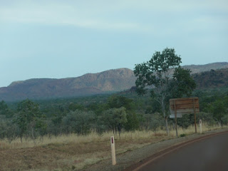
Limited patches of flat land came and went as we wound our way through the hills. It was easy to see why this land is so prized for cattle grazing.
And every so often there was the reminder that, despite the remoteness of this highway, complacency could be fatal. One can never tell what might be over the next hill or around the next bend. As our experience had taught us, road trains can appear both with, and at, frightening speed.
As we approached this bend, with its very appropriate cautionary sign, we were treated to the Kimberley in microcosm. A functioning windmill, adjacent cattle yards,
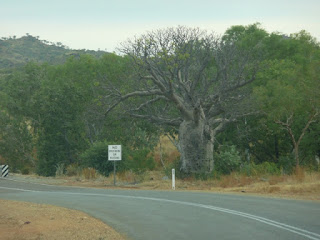
a large roadside boab tree
and a single lane bridge (with no give way signs on either approach). No matter how many times I have seen them before I still chuckle reading the 'no overtaking or passing' signs on the approaches to these creek crossings. Duh! Mind you, if anyone were to make the attempt, this was just the spot....we were crossing 'Mistake Creek'!
This is really 'picture postcard' country despite the gloom. Sadly the photos do not do it justice.
There was something new around every bend. Oh for bright sunlight!
Another single lane bridge and another dry river crossing over the typically wide, shallow watercourses of this part of the country,
and another red hill in our windscreen.
We were now well into the O'Donnell (to our left) and Carr Boyd (to our right) Ranges country. The private road into the famous Argyle Diamond mine was behind us.
Every now and again we were reminded of the need for the need to keep a good lookout (this is made even more challenging when the scenery is so spectacular)
and, then, as we made our approach into Doon Doon, finally a glimpse of sunlight on the distant range. Although we had already realised we have to return to the west for many reasons, the prospect of travelling through here in bright sunlight was another.
Just over a hundred left to run. Time for a quick stop and a splash of diesel (just enough to make it......the prices at some of these outback roadhouses are nothing short of a gouge)
We noted on arrival that the caravan park icon on the roadhouse sign had been crossed out. And indeed, as we confirmed, the park adjacent to the roadhouse itself has been closed.
This struck us as something of a shame. Doon Doon is a pretty little spot and would have otherwise gone into our 'keep in mind for next time' book.
Here we were again reminded of where we were. Signs posted on all the fuel bowsers made it clear that they would not be activated until the prospective purchaser had delivered his or her driver's licence to the inside counter where it was held as a guarantee against a 'drive-off'. I wondered if the prices charged per litre had anything to do with this practice. In any event, Liz's presence inside was enough to satisfy the rather overbearing woman behind the jump that we were honourable souls. The whir of the pump was not long in coming and we were soon again on our way.
Our early departure out of Spring Creek meant that we had seen very little of fellow travellers heading in the opposite direction. That was all about the change. From Doon Doon to Kununurra we passed a steady stream. We had no difficulty understanding why those who have not pre-booked at Broome and similar hot spots find themselves back on the road again. This part of the world is swarming with grey nomads and backpackers at this time of the year.
Unlike many of those we had crossed to date on this day's trip, the Dunham River still boasted a goodly trickle.
It was but a few minutes beyond this crossing that we began to pass many kilometres of plantations. At this stage these were a complete mystery to us. All was to be revealed later (to us and to you, dear reader...this is your puzzle for the day...the only clue at this point...this view is one of big money!)
More roadside boabs came and went,
and here we were. Short of heading off along the dirt tracks north into the top end Kimberley, we were as far north in Western Australia as we could go (apart from a jaunt up to Wyndham which we did later).
We were on the last stretch for the day....just under fifty kilometres into the continuing haze and we would be there.
Sorry folks, I cannot resist these boabs....they are just so old and grand looking.
At last we were crossing the Ord River. Surely there is more to it than this? There is as we later discovered, but this was our first glimpse.
Within no time we were making our way across the rampart of the Kununurra diversion dam.
Off to our right stretched the tranquil waters of Lake Kununurra
and to our left the release waters poured downstream into the Ord River watercourse. We were to see much more of the Ord a few days later.
We had arrived. Now to find our caravan park and settle in for a few days.
As it transpired we had a very busy time here in Kununurra. There really was so much to see and do and we had decided that this was to be our 'one and only' here. We had to make the most of our time.....and we did! (which helped contribute to the fact I am so far behind with these travellers' tales.....there was not time to be sitting for hours at a computer)


No comments:
Post a Comment