On the basis of the 'precautionary principle' we made a booking at Mossman for one week with the view that if all went well, we would extend to two. A beach some 15 kms or so to the north of Mossman had been in my sights for some time, but pet compatibility and the facilities offered remained unknowns. A recce was called for before any decisions were taken.

So it was farewell to Lakeland and the dry tropics as we retraced our steps south along the Mulligan Highway where we continued to share the blacktop with wandering cattle at a number of points (this is part of the country where the signs 'Beware Cattle On Road' are taken seriously)

as we made our way further south through the picturesque Sussex Range to its crest ridge

where a significant climb or descent as the case may be is rewarded with spectacular views back over the range, and, in the other direction

across the plains below on the approach to Mount Carbine and beyond.
This is the last of the real driving challenges on this stretch of the highway (we came up in 3rd and descended in 2nd). Although a few hilly sections lie between here and Mount Molloy, where we turned off the Mulligan to make our way down the eastern slopes of the Great Dividing Range to Mossman, there is nothing to compare with this mountain.
We did not stop at Mount Molloy on our outward journey but did so on our return. From the infrastructure evident along the short main street, which is really the highway, a great deal of its current day survival is obviously linked directly to tourism.
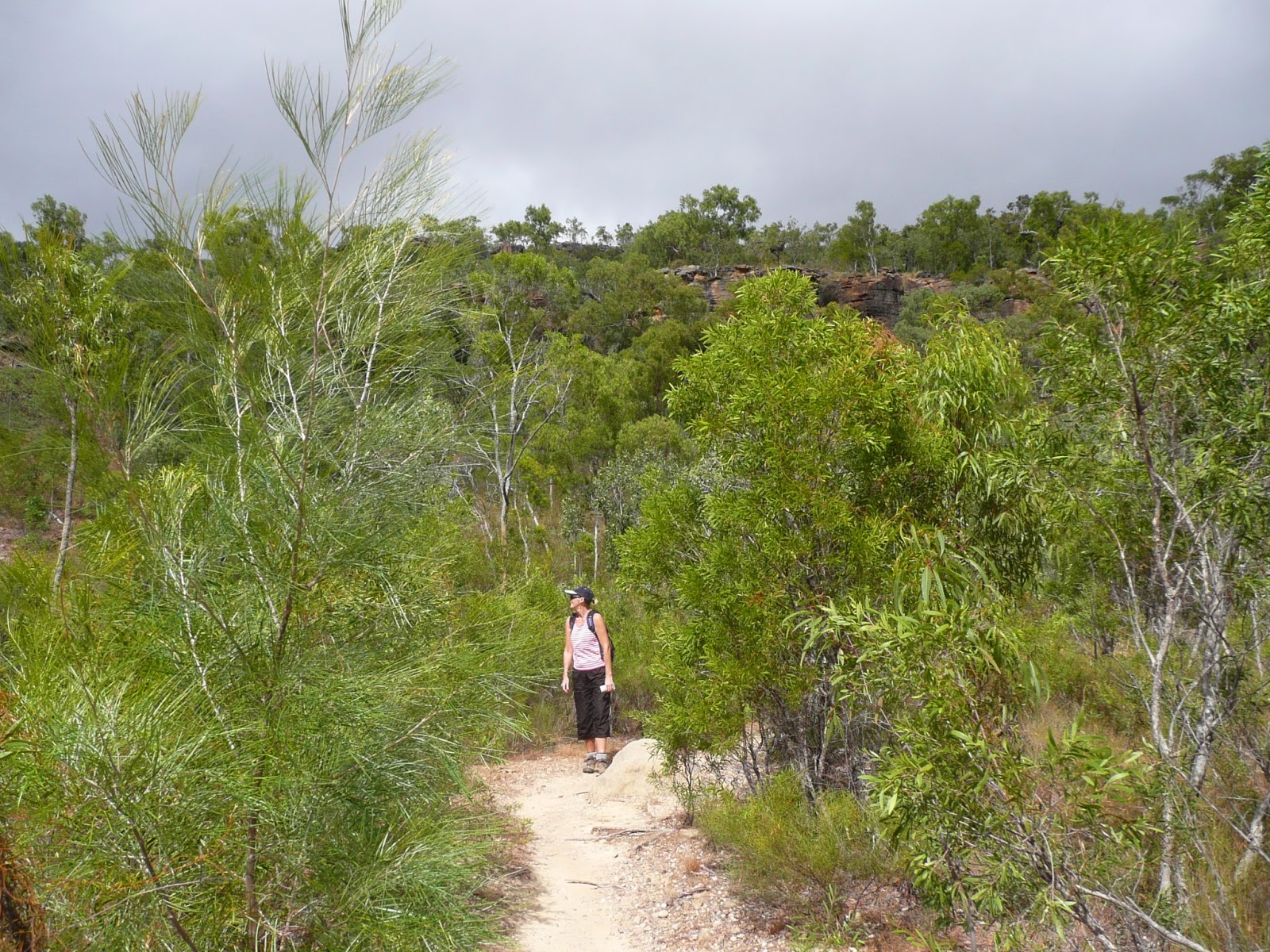
 Just to the north of the town the Rifle Creek free campsite attracts myriads of RVers who are entitled to a 48 hours stay in what has to be one of the better sites of its type. At the time we travelled through it was relatively quiet compared to what we had noted previously. This is one of those spots where a very early arrival reaps the reward of a choice site, and, as those with experience know, allows the space to extend one's awning before the hordes descend on every available inch of space.
This photo shows but half of the area set aside for this park which we estimate could be holding anything up to fifty rigs on any given afternoon at this time of the year. Aside from the fact that there is no formal park in Mount Molloy, the area is noted for the plethora of birdlife which abounds in the surrounding hills. Many we know have spent their full 48 hours here in pursuit of feathered sightings. Apart from that, it is a convenient resting place when travelling to and from the Cape or up from the coast.
A short walk from the camp into town brings one to the excellent Mount Molloy pub,

where, for the princely sum of $6.00, more than adequate lunches are available in either the

'colourful' front bar

or the adjacent 'rustic' beer garden.
Liz and I made a return visit to Mount Molloy whilst in Mossman and partook of the fare on offer. To be frank, for the price, I expected minute servings of the limited menu choices available, but no....Liz had a barra burger to rival any we have seen elsewhere in the $15 - $20 price range and my cottage pie and veggies was quite enough to blunt the inner gnawings. To add to our delight, another couple munching away at the same time noticed the Glenelg SLSC T shirt I was wearing. Long story short...not only were they from Adelaide but knew one of my old surf club mates who was also a stalwart of the Brighton Rugby Club where he had played for many years in the same team as our new acquaintance. I must say I was somewhat relieved to have had this encounter. Our 'we know everyone in Australia' yarns have been a bit thin on the ground this trip compared to last year.

Apart from the pub, those in search of food and drink are catered for at the nearby café/service station, or at a third food outlet which boasts the 'best hamburgers in the world' (a sign we have seen on many such establishments...ACCC investigators have been dispatched!) We were initially going to put this claim to the test, until seduced by the siren call of the pub's $6.00 offerings.
A post office, souvenir shop and one other tempting punters to leave with an array of boulder opal pieces, complete the commercial picture of Mount Molloy's main drag. But I did note one curious derelict building on the edge of town, which indicated to me that there was more to Mount Molloy than currently met the eye.
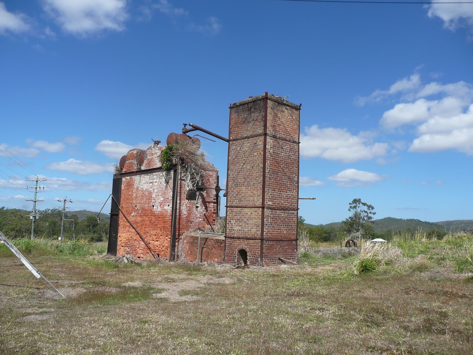
And so it was. Enquiries with a few of the locals revealed that the town had begun life in the late 1800's as a thriving copper mine. A large sawmill was later added to the industrial landscape. This ruin is that of the boiler complex which provided steam driven power for the mine machinery, smelter and for the saw mill. Ghosts of the past!

At Mount Molloy we left the Mulligan Highway and travelled through the last of the 'dry tropic' grazing lands where eucalypts and lush grasslands were the main features of the landscape

until, with almost a flick of a switch, we found ourselves once again in the 'wet tropics'. The difference....rainfall. Once out of the rain shadow of the Great Divide and onto its eastern slopes, the eucalypts give way to the dense tropical forests which can only survive and flourish in areas of high and constant rainfall. It is almost like crossing South Australia's Goyder line. The entire topography changes almost instantly.
Fortunately for weary drivers towing big lumps behind them, the steep descent down to the coastal plains is relatively short, a mere 8 kms or so. And as with most of these challenges come rewards...some great views.....

(this one along the Daintree coast towards Cape Tribulation would have been infinitely better if the day had not been so hazy.)

With the ranges behind us we finally made our way through the main street of Mossman

to the entrance of the Mossman Caravan Park, our home for the next week, if not two (as it eventuated). The large car park pictured serves to house the vehicles of those using the 50 metre public pool which is now part of the caravan park complex, but, as we noted later is also used as an overflow park at this time of the year for those waiting for an available site.
We still cannot believe that people just show up at places as popular as this with the expectation that a site will be available....utter naivety. We had booked well in advance, although we were somewhat miffed to discover that to secure a second week we had to make a decision within the next two days and pay the full amount in advance. This was to be the first a number of incidents and observations which have led us to conclude that those running this establishment have a great deal to learn about doing it properly.
But, minor annoyances aside, our site was a beauty. Plenty of room, a good slab, and, most importantly of all,

a good grassy rear 'beer garden' where the washing line can take pride of place until happy hour.

And of course, once settled in for a reasonable stay, the urge to fire up the galley and replenish the freezers with all sorts goodies invariably rears its head (all under the watchful eye of the killer guard cat)

Our choice of this park was driven in part by the fact that, as I mentioned previously, it houses the town's very good 50 metre swimming pool, access to which is free for park guests.

Despite a 'chilly' water temperature of 24 degrees (not at all cold for us southerners) I had been making the most of the chance to reverse the detrimental effects happy hour has on one's physique when, as I reported earlier, I was struck down with shingles, the result of which, five days later, is this wonderful sight (and it is still a work in progress). Go the anti-virals! And if I needed any other evidence of being unwell, the fact that 'the matron' has been sympathetic and very 'nurse-like' is a dead giveaway!


Fortunately we had managed to visit the Mossman Gorge, Wonga and Newell Beaches and the Daintree and Cape Tribulation before things had deteriorated to the point where a lack of sleep and general malaise rendered me somewhat less than normally energetic. More of those adventures, the Mossman show, and Mossman township to come, but probably not for a few days.
We leave Mossman tomorrow morning (Monday 29th) for three days at Fishery Falls and thence back to Kurrimine where, hopefully, available time and renewed vigour will enable me to catch up blogwise. Until then, "pass the pills!"
We leave Mossman tomorrow morning (Monday 29th) for three days at Fishery Falls and thence back to Kurrimine where, hopefully, available time and renewed vigour will enable me to catch up blogwise. Until then, "pass the pills!"