How on earth could it take five days to reach Perth from Kalgoorlie the sage amongst you are thinking. It didn't. Our quest for wind assistance, or more to the point, an avoidance of head winds, meant that we left Kalgoorlie with a revised target for the day...Northam rather than Merredin. This meant that we would now be well ahead of schedule.
It also meant that by the time we had completed the 500 kms of this leg I was really feeling my age, and for once was prepared to admit it! I knew that once we reached Fremantle things were likely to become pretty hectic (as indeed they did) and we both agreed that a spell in Northam was what was needed. I even took a break from serious sightseeing and photography. We did potter about a bit, but by and large we spent our time in Northam with our feet up for a few days.
Coolgardie was the first town through which we passed after leaving Kalgoorlie. Although now completely overshadowed by the size and enterprise of Kalgoorlie-Boulder, Coolgardie, which is still sometimes referred to as 'The Old Camp', was the site of the first of the regional gold discoveries which saved the fledgling colony of Western Australia from economic ruin.
Coolgardie was the first town through which we passed after leaving Kalgoorlie. Although now completely overshadowed by the size and enterprise of Kalgoorlie-Boulder, Coolgardie, which is still sometimes referred to as 'The Old Camp', was the site of the first of the regional gold discoveries which saved the fledgling colony of Western Australia from economic ruin.

News of the discovery in the mid 1890's brought thousands of struggling hopefuls from Perth and other parts of the country to try their luck. In fact, by 1898, Coolgardie, with its population of just over 5,000, was the third largest town in the colony. Whilst the amount of gold extracted from the Coolgardie area was significant, its real importance in history lies in the fact that it became the point from which prospectors struck out to subsequently make the finds which resulted in the WA Goldfields as we now know them. As can be seen from the shot of the main street, Coolgardie is very much smaller than its immediate goldfields neighbours but,

like them, does boast some wonderful old buildings which stand as testament to the wealth of its beginnings.

Beyond Coolgardie, on our route west to Southern Cross and beyond, we were accompanied for many, many kilometres by the great Perth-Kalgoorlie water pipeline. This is an extraordinary feat of civil engineering, about which I'll have a bit to say in the 'Kalgoorlie' blog.

Our 220 kms leg to Southern Cross took us through the Goldfields Woodlands and Boorabbin National Parks (the pipeline track can be seen in the far distance to the right of the highway) for what seemed to be interminable kilometres

until we were finally in the (unremarkable) main street of Southern Cross. This is probably an opportune time to explain that whilst 220 kms doesn't sound like much of a distance, in a normal car when travel at a constant 110 kph is possible, this is so. But our average speed, taking into account rest breaks etc. is 80 kph, which obviously means our haul to Southern Cross took us nearly three hours.


No such indulgences for those on a mission. Southern Cross marks the end of the woodlands areas and the beginning of what is known here in the West as the 'Wheatbelt'. As we discovered, it is just that, as we could see from this vantage point on a bridge over the East-West railway line. In fact, from this point on we were very much reminded of the countryside in many parts of South Australia.
By the time we had reached Merredin, another 110 kms further to the west on the Great Eastern Highway, it was time for a lunch break. We managed to snag a lovely spot under shade near the railway station where I ignored the marked parking bays and just propped in what were at the time of our arrival, largely open spaces.

By the time we had finished our midday munch, we were surrounded on all sides by locals in their correctly parked cars doing exactly the same thing. A couple did give us the eye...I was beyond caring.....just blame the ignorant visitor is my newly acquired view. Or, put another way, I have decided there are times when there is much to be said for the old maxim, 'ask for forgiveness, not permission'!
We did get a glimpse of part of Merredin's CDB from our parking spot. From this, and what

we saw entering and leaving, it appears to be a somewhat affluent looking country town of some size. We have it one our 'return visit' list, but for the time being, it was onwards to Northam.

I recall sometime ago reading about the problems being experienced in the WA wheatbelt as a result of the clearance of the trees across the cropping land. The result, over time, was a raised water table which in turn pushed corrosive salts to the surface with disasterous results. We saw many examples of this as we travelled further west (still in company with the pipeline).

So, from Merredin we pushed onwards through the small grain towns of Kellerberrin, Tammin and Cunderdin, where the roadside grain silos and railway sidings reminded us both so much of many similar towns in the grain growing districts of SA, particularly in the Mallee.

Cunderdin did throw up one surprise.....The Ettamogah Pub (photographed very much on the run). This is the third reproduction of that icon of the old cartoon series 'Ned and His Neddy' we have found in our travels to date. The Herberton Village and the Sunshine Coast both host similar attractions. I was sorely tempted to check its wares, but we had a schedule to keep, even if only self-imposed.
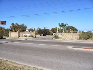
The last small town through which we passed before reaching Northam was Meckering, a name I am sure will ring a bell with most (of a certain age that is!)
At 1059 hours, on 14 October 1968, the town of Meckering was destroyed by an earthquake which measured 6.9 on the Richter scale. Whilst this is a relatively modest reading in the earthquake scheme of things, the real sting in the Meckering quake's tail lay in the fact that its epicentre was only seven kilometres below the surface. The 40 second tremor produced a surface fault some three metres high and over 40 kms long, parts of which can still be seen today. The earthquake was of sufficient magnitude to be felt as far afield as Geralton in the north and Esperance in the south. Miraculously, no-one was killed, in Meckering itself, or in the nearby towns of Northam and York, both of which sustained building damage.
I must confess that by now I was feeling somewhat shattered myself and very glad that Northam was but 35 kms further on. The township lies off the main highway, and I was relieved to discover that the Northam Caravan Park was situated on the road into the town.

What a pleasure it was to heave to at the park office where the delightful surrounding gardens presented a real welcome.

We soon realised that the park owners have gone to incredible lengths to beautify this park with wonderful displays of roses in particular.

It was interesting to later discover that many of the large and well appointed cabins in this park are on the market as permanent residences. Apart from the natural gardening instincts of the park owners, the potential commercial advantages of providing such lovely surrounds were obvious to us.
But for now it was time to get on site. We were originally offered a drive-through, but it proved to be a shocker...narrow and uneven...very much an 'overnight only' site. Fortunately others were available. My choice, based entirely on the shade on offer, proved to be challenging.

One of the shade trees reduced the available width of the site considerably. Coupled with the facts that the entrance roadway was narrow and did not allow much manoeuvring room, the cement block borders were unforgivingly high, and the van had to be precisely sited to allow room for the cruiser, we did have a spot of fun getting settled.
And here I received another sharp reminder of the effects of travel weariness. To my great embarrassment, and for reasons which I can only put down to fatigue, I initially directed Liz onto the wrong side of the site. I am now a decided devotee of the maxim which proclaims that tiredness can have the same effects as alcohol when it comes to driving and similar functions.
As it was, once I got things right and gave directions which actually made sense, we only just had enough room to extend the awning. But after we had finally sorted things out, we found this to be a lovely spot in which to spend a few days. At least my judgement about the shade was correct, and with that and our own private walled garden, pleasant neighbours and an interesting town nearby, we very much enjoyed our sojourn in Northam.
Northam is a town of significant interest. We intend to return later to properly investigate its historical import. That being said, we shall now jump a few days. Perth beckons still.

Our 100 kms journey from Northam to Fremantle took us through the Darling Ranges which lie to the east of the city. As we drove through the rolling green hills we were taken by how much they reminded us of the Mount Lofty Ranges (with apologies for the unwanted effects of the bug ridden windscreen).

This similarity was compounded as we finally began to descend onto the Perth plains in increasing traffic. A multi-landed highway, warnings of steep descents and arrester beds were all so familiar.
And, finally, after our two week, 2,700 kms journey from Adelaide, the skyline of Perth was in sight.

It had been quite some time since I had been required to tow the van through anything like a large city. I must admit to being a touch tense as we made our way down the final stretch of the Great Eastern Highway into the maelstrom of Perth traffic.
God bless the co-pilot....she had programmed our trusty Tom Tom to perfection and 'Ken', our electronic navigator guided us with a sure hand off the Great Eastern Highway, along the Roe Highway and thence through the South Fremantle side streets until he announced in his usual measured tone,
"You have reached your destination". And indeed we had, the Fremantle Village Caravan Park, 25 Cockburn Road, South Fremantle, our home for the next ten days.

This is an interesting park. As I drew breath in the arrivals lane and surveyed the office block and its large visitor's car park, I knew this was to be a far cry from the rustic and often dry and dusty parks to which we had become used over the past months.

I recall sometime ago reading about the problems being experienced in the WA wheatbelt as a result of the clearance of the trees across the cropping land. The result, over time, was a raised water table which in turn pushed corrosive salts to the surface with disasterous results. We saw many examples of this as we travelled further west (still in company with the pipeline).

So, from Merredin we pushed onwards through the small grain towns of Kellerberrin, Tammin and Cunderdin, where the roadside grain silos and railway sidings reminded us both so much of many similar towns in the grain growing districts of SA, particularly in the Mallee.

Cunderdin did throw up one surprise.....The Ettamogah Pub (photographed very much on the run). This is the third reproduction of that icon of the old cartoon series 'Ned and His Neddy' we have found in our travels to date. The Herberton Village and the Sunshine Coast both host similar attractions. I was sorely tempted to check its wares, but we had a schedule to keep, even if only self-imposed.
The last small town through which we passed before reaching Northam was Meckering, a name I am sure will ring a bell with most (of a certain age that is!)
At 1059 hours, on 14 October 1968, the town of Meckering was destroyed by an earthquake which measured 6.9 on the Richter scale. Whilst this is a relatively modest reading in the earthquake scheme of things, the real sting in the Meckering quake's tail lay in the fact that its epicentre was only seven kilometres below the surface. The 40 second tremor produced a surface fault some three metres high and over 40 kms long, parts of which can still be seen today. The earthquake was of sufficient magnitude to be felt as far afield as Geralton in the north and Esperance in the south. Miraculously, no-one was killed, in Meckering itself, or in the nearby towns of Northam and York, both of which sustained building damage.
I must confess that by now I was feeling somewhat shattered myself and very glad that Northam was but 35 kms further on. The township lies off the main highway, and I was relieved to discover that the Northam Caravan Park was situated on the road into the town.

What a pleasure it was to heave to at the park office where the delightful surrounding gardens presented a real welcome.

We soon realised that the park owners have gone to incredible lengths to beautify this park with wonderful displays of roses in particular.

It was interesting to later discover that many of the large and well appointed cabins in this park are on the market as permanent residences. Apart from the natural gardening instincts of the park owners, the potential commercial advantages of providing such lovely surrounds were obvious to us.
But for now it was time to get on site. We were originally offered a drive-through, but it proved to be a shocker...narrow and uneven...very much an 'overnight only' site. Fortunately others were available. My choice, based entirely on the shade on offer, proved to be challenging.

One of the shade trees reduced the available width of the site considerably. Coupled with the facts that the entrance roadway was narrow and did not allow much manoeuvring room, the cement block borders were unforgivingly high, and the van had to be precisely sited to allow room for the cruiser, we did have a spot of fun getting settled.
And here I received another sharp reminder of the effects of travel weariness. To my great embarrassment, and for reasons which I can only put down to fatigue, I initially directed Liz onto the wrong side of the site. I am now a decided devotee of the maxim which proclaims that tiredness can have the same effects as alcohol when it comes to driving and similar functions.
As it was, once I got things right and gave directions which actually made sense, we only just had enough room to extend the awning. But after we had finally sorted things out, we found this to be a lovely spot in which to spend a few days. At least my judgement about the shade was correct, and with that and our own private walled garden, pleasant neighbours and an interesting town nearby, we very much enjoyed our sojourn in Northam.
Northam is a town of significant interest. We intend to return later to properly investigate its historical import. That being said, we shall now jump a few days. Perth beckons still.

Our 100 kms journey from Northam to Fremantle took us through the Darling Ranges which lie to the east of the city. As we drove through the rolling green hills we were taken by how much they reminded us of the Mount Lofty Ranges (with apologies for the unwanted effects of the bug ridden windscreen).

This similarity was compounded as we finally began to descend onto the Perth plains in increasing traffic. A multi-landed highway, warnings of steep descents and arrester beds were all so familiar.
And, finally, after our two week, 2,700 kms journey from Adelaide, the skyline of Perth was in sight.

It had been quite some time since I had been required to tow the van through anything like a large city. I must admit to being a touch tense as we made our way down the final stretch of the Great Eastern Highway into the maelstrom of Perth traffic.
God bless the co-pilot....she had programmed our trusty Tom Tom to perfection and 'Ken', our electronic navigator guided us with a sure hand off the Great Eastern Highway, along the Roe Highway and thence through the South Fremantle side streets until he announced in his usual measured tone,

"You have reached your destination". And indeed we had, the Fremantle Village Caravan Park, 25 Cockburn Road, South Fremantle, our home for the next ten days.

This is an interesting park. As I drew breath in the arrivals lane and surveyed the office block and its large visitor's car park, I knew this was to be a far cry from the rustic and often dry and dusty parks to which we had become used over the past months.

This was precisely so. When I booked our spot many moths ago from Adelaide, and was asked the size of our van, I was promised a drive-through site on the basis of the fact that this would certainly accommodate us with ease.True enough. I couldn't believe the dimensions of the pad which awaited us. And there was lawn, lawn and more lawn. I was in caravan park heaven. There was even room for another vehicle at the back of the van....we made good use of this later.
The lawn and slab proved to be of special benefit the day after our arrival, when the skies opened and Perth received a 15 mm dump of rain. We remained relatively dry underfoot.

Apart from its caravan sites, of which we later discovered we had one of only four drive-throughs, The Freo Village offers both short and long term accommodation in rows and rows of these oddly shaped cabins. Many were occupied with folk who were obviously going to work each morning and who had made this park their home. Great for the cash flow.

And I have to say, the area in which campervans and smaller mobile homes are ensconced is one of the best designed we have ever seen. Each site comes with its own wooden picnic table and bench set.....what an innovation this is.
The only real drawback with this park, in common with the vast majority of Perth city caravan parks......NO PETS! Poor old Max....it was off to the cattery in Canningvale for him. Frankly another drive through Perth traffic over the 20 kms to Max's place of temporary incarceration was the last thing I felt like after we had set up, but we decided that was a better option than tempting fate and having him discovered overnight.
And so, after a relatively quiet weekend, a highlight of which was a visit from one of my oldest friends, 'JFJ' of Brighton B2 hockey team fame (John Finlay-Jones, who now holds the position of Vice-Chancellor (Research) at the Edith Cowan University in Perth, was the assistant Dean of Medicine at Flinders Uni for many years), we began the week our my UN reunion. What a hoot. Highlights (tastefully edited!) in my next post.


