The bedroom window in our cabin at The Junction faced east. We were up with the sunrise....well, your scribe was. "What's the rush?" was the muttered grizzle from under the quilt. "Come on Liz, we've a lot to do today." But there was to be no hurrying the Matron when she was on a day off.....we left two hours later.

We drove out past the local school,
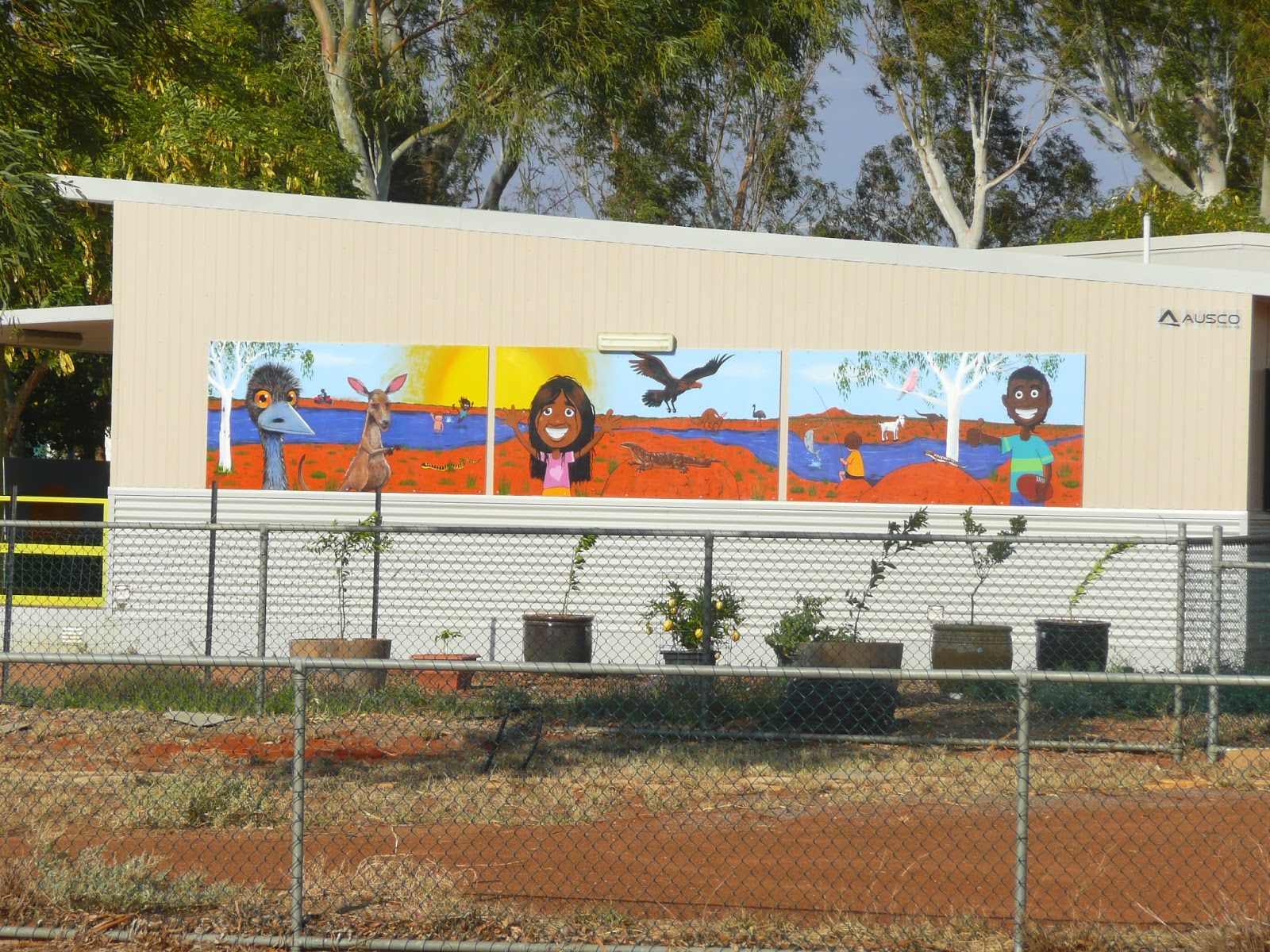
with its colourful wall mural

and made our way to the Gascoyne River crossing. This is some crossing indeed. This is the first section of the causeway

which leads to the second cement section which traverses the main channel of the river.

It was just as well that the river was not flowing. This section of the causeway was only half a metre above the river bed. We could see a shimmer of water in the distance.That must the the local picnic area.

Finally we began to climb out of the river valley on the last section where, for some unknown reason, the roadway is unsealed.

There are a few houses on this side of the stream which obviously survived the last flood. One posts a stark reminder of days past...this lot are clearly survivors!

So does the Gascoyne have any water in it at this time of year? Indeed it does, as we discovered when we nosed along the roadway signed 'picnic area' and pulled up at the bank. Looking upstream we were taken by just how much this reminded us of many sections of the River Murray we had seen in our house boating days.

It was a similar story taking in the downstream view. What a delightful spot at which to break out a sandwich or two and open a chilled bottle.

But we had no time to stop. We were on a mission. A cattle grid heralded the beginning of the dirt and our 60 kms run to the Kennedy Range.

This is definitely cattle country. Large signs warned of the potential presence of wandering bovines. Fortunately we only shared the road with them on one occasion.
I was pleasantly surprised with the quality of the surface for the major part of our trip. This was a road on which we could manage 100 kph without any challenges. But this was not always so as we discovered.

I had actually driven past this sign before suddenly thinking "what on earth is a 'cobbled road' doing out here?" After a quick U turn a real story unfolded.

And there it was, cobbled, level, and straight.....and running right through the bush in the middle of nowhere. Fortunately a nearby explanatory plaque told the story.
In the days of yore, goods and wool were transported through this country on camel drawn drays which followed rough tracks through the scrub. With the advent of the motor lorry, the cameleers became concerned about their futures, and began to deliberately denigrate the tracks to render them impassable to motor vehicles.
At about this time, Australia was hit by the great depression. One government initiative to keep men employed, the Sustenance Programme' (a work for the dole scheme), saw thousands head off to the bush to become employed on all sorts of projects, the one consistent criterion of which was that they should be labour intensive.
Thus it was that this cobbled road was laid between Carnarvon and Bangemall goldfields not far from Mount Augustus, distance of over 450 kms. No longer would the mail run trucks spend weeks bogged by the side of the track and the days of the camel were over.
An interesting aside to this story lies in the fact that Sir Charles Kingsford-Smith was one who had bashed through this bush before the road was laid. He and Keith Anderson had bought a transport and garage business in Carnarvon in 1924 as a means by which to raise funds for his flying exploits. One of their contracts was to haul the mail and other goods from Carnarvon to Bangemall. The tenacious and inventive Smithy soon developed a reputation for reliability notwithstanding the many challenges he faced on this run but had sold the business before the new road made many of the problems he faced a thing of the past.
I left this remnant section of the cobbled road trying to imagine just how hard the yakka must have been to dig, grade, transport and lay the myriads of small stones used in its construction in an area where summer temperatures reach the 40's and often do not drop below maxima of the low 30's in winter. These were tough times indeed.
It was not long past here that the first humps of a section of the Kennedy Range loomed on the distant horizon across the sparsely vegetated plains.

These were not our destination, but they did set the scene. We were now approaching the Lyons River and

another causeway crossing. (if you look closely you will see a kite taking off across the roadway..I would like to claim photographic brilliance but I know you would all know better...this was a sheer fluke). But would the Lyons, the second of the significant rivers in this area, be carrying water?

Not a drop, either upstream

or down, but it was clear that this would be no mere trickle when the rains broke over the catchment.

And then the turn off to the park....the ramparts of the escarpment were in sight. Only 12 kms to go and this was just as well. From here the road deteriorated badly...heavy corrugations and rough clay washouts saw a rapid reduction is speed and the adoption of eagle eyes by both driver and navigator.

Was it worth the discomfort....every second of it. The closer we got the more spectacular the scenery became.
The Kennedy Range was once the seabed. The compressed sandstone was later pushed upwards and erosion over millennia has left a sandstone rock plateau 12 -25 kms wide and 75 kms long rising some 80 metres above the plains which surround it. The constant run off of water after heavy rains has resulted in the cutting of the many gorges which are a feature of this range. We were to visit one of them.

But first stop was the information board at the entrance to the park. We though we knew where we were going, but it always pays to double check.

A right turn at the intersection just ahead of us will take us to Honeycomb Gorge, our first planned 'hike'. There are four recommended walks in this part of the range. Two were rated as relatively easy. The others we decided were potentially too much for my ageing and decrepit knees and would take time we did not have.

The forbidding battlements of the range rose imperiously out of the rocky plain along the road to the gorge. This was stunning scenery.

In no time at all we had turned off the main track onto the access road to the gorge car park

But first stop was the information board at the entrance to the park. We though we knew where we were going, but it always pays to double check.
A right turn at the intersection just ahead of us will take us to Honeycomb Gorge, our first planned 'hike'. There are four recommended walks in this part of the range. Two were rated as relatively easy. The others we decided were potentially too much for my ageing and decrepit knees and would take time we did not have.
The forbidding battlements of the range rose imperiously out of the rocky plain along the road to the gorge. This was stunning scenery.
In no time at all we had turned off the main track onto the access road to the gorge car park
where the southern end of the gorge knifed into the sky.

Like so many other trails we have trodden, our path in began with an easy stroll along a sandy track,

but all this soon changed as we picked our way through the rocks and boulders, assiduously following the marker discs which designated the track to take.

I did note a ring-in at one point. Was a previous visitor trying to tell the park rangers something?
Like so many other trails we have trodden, our path in began with an easy stroll along a sandy track,
but all this soon changed as we picked our way through the rocks and boulders, assiduously following the marker discs which designated the track to take.
I did note a ring-in at one point. Was a previous visitor trying to tell the park rangers something?

Fortunately our scramble was only some 500 metres long. We could soon see the stained rock face down which the waters which have formed this gorge have flowed for countless years.

Would there be any water in the pool at the bottom? Sadly, no,
but the honeycomb patterns in the rock face above the sand of the pool bed were spectacular nevertheless, and, if you look closely at the bases of many of the water carved

niches you will see that pebbles and small rocks have been deposited in them. It is obvious that when the water flows here things can become pretty exciting.

And it was a bloody long way to the top. Too far for my puny camera lens. This shot makes it about two thirds of the way.
We ogled about these intricate and fascinating rock faces for some time. This is one of those places where the more you look the more you find. I can only imagine just what a magic place this must be when the rains have come and gone and the pool is full of crystal clear water.

"Time to move on Lizzie." So it was back out the way we came in to the car park and the cruiser.

Sunrise View was a short hop further along the road over which yet another wall of towering rocky bluffs stood in defiance of nature's efforts to erode them away.

Once there we could understand how this site was given its name, but we first had a spot of work to do.....climb the winding, steepish track to the small 'viewing platform' which can be seen here (about mid shot) faced with a white coloured rock.

Again, the result was well worth the effort. From this modest elevation we could see north along the line of the escarpment

and to the east, we had a view across the mulga plains for miles and miles. We could now understand why it is recommended that one visits here at sunrise.

Even the viewing platform had points of interest, and one of them initially fooled the co-pilot. "Why would there be bricks up here?" "No idea", was my response. "Where?" I had to admit she had a very good point. At first glance this small area of the sandstone deposit looked for all the world like rows of paving stones.
Many visitors to this area leave their vans at The Junction and, as we did, visit the Kennedy Range as a day trip.
Some even do the same to see Mount Augustus. In typical WA style, that is also advertised as a 'day trip'. The fact that this actually entails a round trip of some 600 kms on unsealed roads of varying states of repair does not seem to be considered relevant in the least. We had long ago decided that the potential pleasure of gazing in wonder at the largest monocline in the world (this rock is twice the size of Uluru) was just not worth a bash of that length....but plenty do make the trip.
At both Mount Augustus and the Kennedy Range National Parks, camp sites are on offer to those who wish to spend some time communing with nature. We would never consider hauling our rig over these roads, but we thought it would be silly not to at least see what was available whilst we were here, from a potential advisory perspective if nothing else.
About turn and back towards the main park entrance road. And another of the ever changing views of this incredible plateau.

The Temple Gorge campsite is within 500 metres or so of the information board at which we had first stopped. Here we found a variety of campers tucked into some of the many nooks and crannies of this understandably dry and dusty spot.

Some had come in their 4WD's

and others in a mobile home.

The setting is indeed spectacular and the sites are well organised and marked. We were particularly impressed with the communal BBQ area and had no trouble imagining some of the yarns which had been shared here over the years as the camp fires blazed and crackled under a canopy of brilliant stars.
But for now it was back to reality and the return journey. Just after we drove across the small dry creek bed into the campsite, we saw a 4WD towing a camper trailer leaving. The displayed 'L' plates in the windows confirmed the young age of the driver. Damn, we'll be eating his dust all the way back.
 As it transpired, whilst he did travel at a very sensible speed all things being considered, there was no shortage of dust. Fortunately the prevailing wind carried most of it away from us quickly, but there were a number of times when we just backed right off to put some distance between us. I chose not to overtake for obvious reasons, and hoped that they would allow us to pass when we reached the junction with Ullawarra Road, the main road back to Gascoyne Junction.
To my relief, courtesy prevailed all round. ..we were beckoned through. With exchanged toots and waves we scooted past this rig and turned our heads south.

Let us leave the flat plains of Gascoyne Junction and its surrounds with yet another reminder of the power of the Gascoyne River when in full spate. This mass of white is an accumulation of small river bed rocks spread over the flood plain along the side of Ullawarra Road. They could only get here one way!
We had one more stop to make before returning to The Plantation and our routine of the past 100 days plus....Rocky Pool.
This is a renowned local picnic destination 50 kms east of Carnarvon on The Junction road. We had often planned a trip out here but just never gotten around to it. It had to be crossed off the list!

After four kms along the dirt access road the river came into view. As we pulled into the parking area we could immediately see how this significant pond the in the Gascoyne got its name. The entire bank on this side consisted of large flat rock plates.

We picked our way across the rocks, past this old BBQ which had clearly seen better days,

and there it was....Rocky Pool, here seen looking upstream over the 'deep end' where a good swim would present no problems.
In the opposite direction the river bed becomes sandy and much more shallow. As we took in this delightful scene, a family group was having a whale of a time splashing about in the water downsteam.

What an enchanting place to find in this dry, flat landscape....a fluid fun oasis extraordinaire! We now lamented the fact that we had left it so late to make our first visit.
This was marvellous way in which to end our 24 hour whistle stop tour of Gascoyne Junction and the Kennedy Range. As for Max, when we reappeared at the vet's and arranged his parole you could have been mistaken for thinking we had been away for a fortnight.....what a smoocher he is when he first returns to his mobile home after a stint in incarceration.
Just over a week to go......our thoughts were now turning to the myriad of tasks associated with breaking camp and preparing to haul south. It has been so long since we have had to pack up and hitch we have broken out our checklists for a quick revision.
As I type (real time Thursday 9 October) Liz has two more shifts to go. We are planning to leave on Tuesday 14 October when hopefully the current forecast of north-westerly winds will be a reality and at our backs. At the moment the van and annex are rocking under the force of a howling 40 km south-easterly.....WA...windy always.....well on this part of the coast at least. I am watching the boughs of the gum trees above our heads with increasing anxiety. It is definitely time to be heading south!
No comments:
Post a Comment