We were on the road again. Destination.....Port Sampson, about 50 kms east of Karratha. We had decided to use this as a staging point from which to visit Karratha itself, Dampier, Roebourne, Wickham and the old town of Cossack as well as the ore loading facility at Cape Lambert. We were in for a busy time, but first we had to get there.
I could not resist one last photo of the Onslow Memorial, not least because on this, our day of departure, I was actually up before the sun rose!

Was I happy with the result....you bet I was! As I walked back to the park I could not help but think of this venue for the Anzac Day dawn service....it would be sensational.

I had hitched the day before, and we were almost ready to go. Chairs in and legs up, Max taken for his final pre-departure walk and it was into his cage and we were off.

Max can be a devil on these days. He knows when he is in for a spell on the road and he does all he can to avoid the outcome. Once the TV goes under the pillow he is off, looking for a place to hide. We have found that he is much more settled if he has a good gallop around the park before we leave. It's amazing.....even in parks where he has not been entirely comfortable too far away from 'his patch', on departure day he will try to walk for miles!
But we're on to you Max....there is no escaping the inevitable. I know....butter wouldn't melt in his mouth. Don't believe a word of it. He has a very effective way of making his presence felt when he has had enough, despite the recent addition to his cage comfort of a large piece of foam padding. Ingrate!

Once again we marvelled at the numbers of the termite mounds in the Cane River Conservation Park as we rolled south-east out of Onslow in the early morning light

and made our way to the junction of the North-West Coastal Highway.

This was to be a moderately long day (for us).....about 350 kms all told, but it was one full of interest. Throughout the trip we were left in no doubt that we were travelling through mining country. This was the first of several overburden heaps and buildings we passed which indicated a mining operation.

The ore carrying trucks of the 'Mesa A' mine soon came into view. This mine, otherwise known as 'Waramboo', is one of many operated by Rio Tinto in this area.

Although this operation is not one of the real monster mines, it has one feature which provides some clue to the costs associated with developing these mines. This was a phenomenon we had first come across many moons ago whilst travelling on the Stuart Highway....a bridge which looms out of nowhere for no obvious reason.

It is not until one reaches the top that the its purpose becomes evident. These are purpose built to allow the ore trucks direct passage to and fro beneath the highway.

And sure enough, here were two of them hard at it. Just imagine the chaos if this were a level crossing.
A short time later this roadside sign loomed through the windscreen. We had never previously

taken a great deal of notice of these....there had been no problems with the roads, and I have to confess to a previous attitude of "Why do they put these up...this is a major highway for goodness sake". Our Nanutarra experience had changed that foolishly blase view of this part of the world for good. Irrespective of the forecasts, which I do watch carefully, we now peer most attentively at these advisory notices. Even more, if a flood watch is promulgated in any area within a bull's roar of our destination, we also check the very informative Main Roads website before departure. Once bitten and all that!

From this point on the landscape changed quite dramatically. We now found ourselves traversing flat open country

as we made our way further north-east towards our planned fuel stop...the Fortescue River Roadhouse.

As we rubbed shoulders on the huge apron with a few of the big boys, typical Pilbara red hills in the background,

I took the opportunity to check out the caravan park at the rear of the roadhouse. This had been another of my planned escape destinations during the approach of TC Quong. We remain eternally grateful this did not eventuate. Apart from the fact that the roadhouse complex includes a large miners' camp (with all the attendant joys this can bring), the park amenities were filthy and graffiti ridden and the caravan sites were but average.
Whilst the interior of the roadhouse itself was of a good standard, the same cannot be said for the fellow behind the jump.....he was slow, grumpy and less than user friendly. Hopefully this place employs other staff. In any event, our score for the Fortescue River Roadhouse was 2 out of 10!

We moved on, over the flowing waters of the picturesque Fortescue River

and into another section of the Pilbara flat lands with hills in the distance. This had been a common place view for much of this trip.
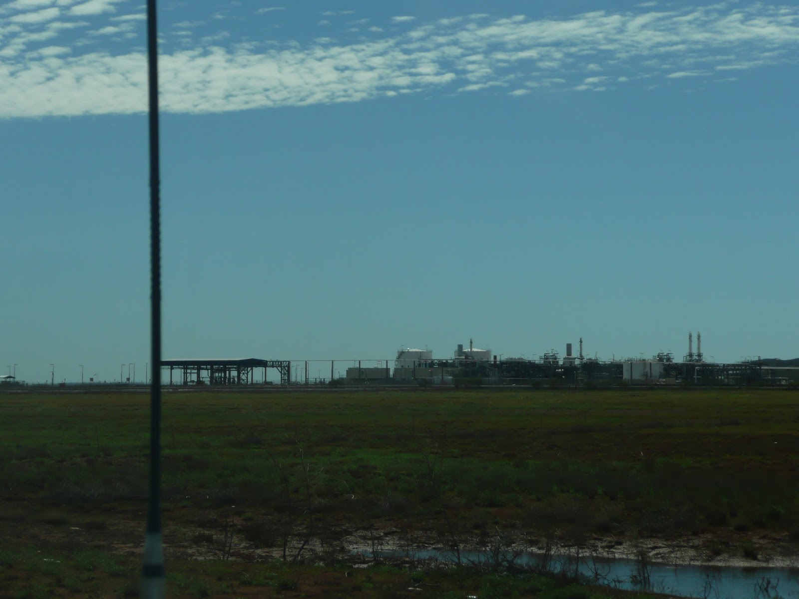
At many points along the way evidence of heavy industrial activity came into view. The Devil Creek gas plant is but one. This plant processes gas brought ashore through 105 kms of pipeline from the Apache operated offshore Reindeer gas platform off Dampier, part of the North-West Shelf gas extraction operation. A smallish, but significant player.

'Gas' and 'iron'....two words synonymous with the Pilbara. No sooner had we passed the Devil Creek gas plant than we were watching the slow progress of one of this region's huge iron ore trains. These have to be seen to be believed in terms of their length. The 20 ore waggons in picture (come on, admit you checked!) were part of a train of at least 200 of them.
Again, we were later to see these at much closer quarters, an experience which did nothing to temper our awe (think about it!) in respect of the sheer magnitude of these ventures.

We were getting nearer. A visit to Dampier and the Burrup Peninsula were on our agenda,

but for now it was on to Roebourne and the turn off to Point Sampson. There is a real concentration of towns and places of interest in this area. This sign listed four of them.

With less than 20 kms now to go we headed out across the flat country which lies between Roebourne and Cape Lambert

past the mining township of Wickham

and the salt pans near the turn off to the old town of Cossack.

The sea was churning in through the culvert as we crossed the tidal inlet near the town

and within a few short minutes we had arrived at the outskirts of Point Sampson which was to be our home for the next week.
As we pulled in were hoping that we had allocated enough time to do all we had planned without running ourselves ragged. Only time would tell, as I shall, in the next few episodes.
No comments:
Post a Comment