The parks and the port.....in Gladstone we found that these two features were inextricably linked, either by virtue of the fact that they lay side by side, or that from one we could clearly see parts of the other. As I mentioned earlier, this creates a visual contrast which left an indelible memory.
But before we wander down to the water, let me return briefly to the southern end of the main drag, Goodoon Street, where we found an 'odd man out' in Gladstone Parks, one which has no direct connection with the port, the marina or any other waterway.

The Gladstone Anzac Park is a delightful green oasis in the valley at the bottom end of the CBD.

And here, as I took a closer look at the fine memorial which stands in the centre of a circular paved area,

I was both surprised and delighted to find a reference to that troubled Mediterranean Island on which I spent a year of my younger life with the UN Forces, 'keeping the peace'. Given that the UN intervention did not commence here until 1964 (our Australian involvement has been continuous since then and only concluded this past June....a record in UN Peacekeeping annals) I am at something of a loss to explain the date 1955. I can only assume it is a reference of some sort to the problems the colonial Brits suffered at the hands of 'General' Grivas and his Eoka terrorists during the bloody campaign waged by them to achieve independence (and believe me it was murderous).
But now back to the port, my old friend Google Earth, and hopefully an overview which enables me to provide some idea of the position of the various parks we visited. It probably goes without saying that the top of this photo features one of the several coal loading facilities. The long wharf is separated from the enclosed small vessel marina by a finger of land which is home to Spinnaker Park. Victoria Park lies on the other side of the marina basin.

Separating both from the CBD district and the industrial areas along Hanson Road, is the Auckland Channel. This allows ingress and egress for smaller vessels, private and commercial, into both the marina and the anchorages further along the channel past the marina entrance.
As you can also see, Victoria Park can be accessed by a road bridge across the channel from central Gladstone. Finally, the green tree symbol opposite the marina entrance signifies the position of Auckland Point with its elevated lookout and James Cook Park, and below that is the white blob which is in fact a huge dump of calcite ready for loading at that dock. Another loading dock (coal) can just be seen at the far right of the shot, and at the other side of the photo the straight line which clips the top left hand corner is actually part of a long loading gantry taking coal out to yet another wharf.
Here is another way of looking at all this, courtesy of the 'abc.net'. The elevated position of the Auckland Point lookout with the calcite dump below it, is obvious at the left of shot, whilst the green expanses of Victoria and Spinnaker Parks dominate the lower section of the photo.

Of course, now the question is.....where to begin? Always take the high ground, has been my philosophy.

Auckland Point it is, where we parked our loan ute in the car park between the observation deck and 'mandatory' cafe

and the lookout itself.

Here is another way of looking at all this, courtesy of the 'abc.net'. The elevated position of the Auckland Point lookout with the calcite dump below it, is obvious at the left of shot, whilst the green expanses of Victoria and Spinnaker Parks dominate the lower section of the photo.

Of course, now the question is.....where to begin? Always take the high ground, has been my philosophy.
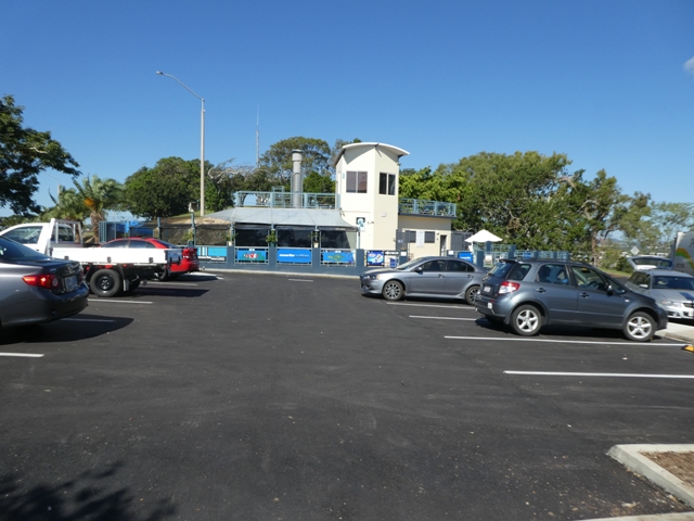
Auckland Point it is, where we parked our loan ute in the car park between the observation deck and 'mandatory' cafe

and the lookout itself.

From here we could see out over part of Spinnaker Park to the power station in the distance with blue ribbons of the various channels snaking through the lower ground.

Further to the right and here we have some of the private vessels moored in the serene waters of the Auckland Channel this side of the bridge which connects Victoria Park to the CBD.

From this vantage point the small vessel marina can be clearly seen, bounded on the left by the edge of Victoria Park and embraced on the other by the 'boomerang' of land which is Spinnaker Park.

Panning a little further to the right and the coal loading wharf adjacent to Spinnaker Park and the hills of Curtis Island beyond come into view,

whilst below us, and further still to the right, is the unmistakable white gleam of the calcite stockpile and loading wharf.

Beyond this the grain silos and oil terminal cover the ground between this part of the port and Barney Point further yet to the right. Away in the distance the faint smudge on the horizon is smoke from the huge Queensland Alumina plant, but I'll have more to say about that later.
From the nearby James Cook Park I attempted a panoramic shot to bring all this together with, by my own admission, limited success. I should add the large building in the centre of the photo houses many staff of the large port authority.

One additional feature of this view, almost hidden behind a patch of bougainvillea mid shot, is the hull of HMAS Gladstone, a decommissioned patrol boat now preserved for posterity in the town which gave it its name. A closer look later.

Our next venture took us out along the roadway which took us past the northern boundary of the marina and on to the entry gateway of Spinnaker Park.

From here we drove further south along the eastern side of the park to a car park some distance from the entrance.

From here it was onto shanks' pony, along one of the several walking trails which circumvent this very well conceived and maintained public space.
This section of the path provided a wonderful perspective across Auckland Channel to the

bulk of Auckland Point and its lookout right at the tip, the Gladstone below, the docks of of the Esplanade Park, and on around to the high rise of the CBD.

From here too we were afforded another view of the calcite wharf with its backdrop of the towering grain silos

and a much better look at HMAS Gladstone in her permanent dry dock. And what a tale this is.
The Gladstone, a old Freemantle Class Australian Navy patrol boat, entered service in 1984. For the next twenty two years she served principally in northern Australian waters where she contributed to fisheries protection, customs and drug law enforcement and immigration operations.
This stalwart vessel sailed over almost 620,000 nautical miles before being decommissioned in March 2006. She was then stripped of all things which go bang in the night, and, as the result of extensive dogged lobbying by the town's civic leaders, sailed to Gladstone where she was gifted to the Gladstone Maritime History Society.
She lay at anchor in the port for several years until, in November 2014, she was finally moved to the defunct slipway of the Gladstone Ports Corporation where she is now open for inspection and serves as a major tourist attraction for the town. I would have loved to go aboard, but sadly she was not open during our visit to this area (and my travelling companion was less than overwhelmed with enthusiasm at the thought).....next time!

The walking path around Spinnaker Park then took us to the western side of this oddly shaped spit of land. Here the sweeping grounds of Victoria Park came into view

as did the marine clutter of the small boat harbour where private yachts and 'stinkies' jostle for room side by side along the finger wharves.

The northern end of the marina basin has a much more commercial focus. Here we find a plethora of boat repair facilities, ship's chandlers and the operating bases for vessels such as the Curtis Island ferries. One of that fleet was making its way out of the marina as I watched.

These are very handy little vessels, with their drop bow allowing for easy vehicle access. And as I later saw, they can carry a healthy payload.

These bright marine workhorses can be seen throughout the day plying the waters of Port Curtis.

The walking path along the western side of Spinnaker Park brought another surprise. Apart from the expected public BBQ's

and a novel public toilet block set into the side of this small rise like an ammunition bunker (this does raise some interesting if somewhat crude ideas about noise abatement and so on!!)

here, in what is more of less the middle of the parkland area, I came across this large freshwater lake

on the surface of which the massed flowers of the water lilies presented a real picture.

By now our ramble had brought us back to the eastern side of the park, a tad nearer the entrance gate, to a small sandy cove

which looks out over the harbour channel and the calcite dock. I have to say that as a potential spot for a refreshing dip this had limited appeal for us, but we were reliably informed it is very well used by the local populace, as are all other parts of all the parks we visited. They clearly form a vital part of the Gladstone public infrastructure. We had no difficulty understanding why.

This side of the park also offers direct views across to the coal loading wharf which can accommodate three large bulk carriers all patiently lying alongside as the huge loading gantries crawl back and forth spewing coal into the gaping maws of the open hatches....day and night...night and day.

Here too finger wharves are home to the fleet of port tugs, extraordinarily powerful and amazingly agile vessels, all of which can spin through 360 degrees on their own axis (as we first saw in Esperance a couple of years ago). It is a such a delight to watch these nimble craft dancing around the huge bulk carriers as they chivvy and cajole them to a position alongside the various wharves.
This is a very busy tug fleet. As I have previously noted the extent of activity here can be difficult to grasp because of the distance from one end of the working harbour to the other, but despite appearances the port of Gladstone is a hive of constant activity.

As this shot of the loading facility we had been viewing from Spinnaker Park so amply demonstrates (thanks to the Port of Gladstone website) coal is king, but it is not on its own.
The deposits from the huge Moura and Blackwater basin mines, which arrive in Gladstone in trains up to almost two kilometres long to be loaded and shipped overseas, do form the greatest part of the export activity, but there is much more going on at the same time.
For the statistically minded here are the facts. Gladstone is Queensland's largest multi-commodity port, is the largest coal export port in the Southern Hemisphere (this was a surprise given what we have seen in the West), and, in terms of coal export, ranks as the fourth largest in the world.
In addition to all this black stuff, aluminium, alumina, bauxite, cement products, calcite, liquid ammonia, and more recently LNG, all leave Australia through the Port of Gladstone. In fact this massive port handles over 30 different export commodities.

Armed with this knowledge, the sight of large ships of all shapes and sizes

constantly on the move through the harbour comes as no surprise.
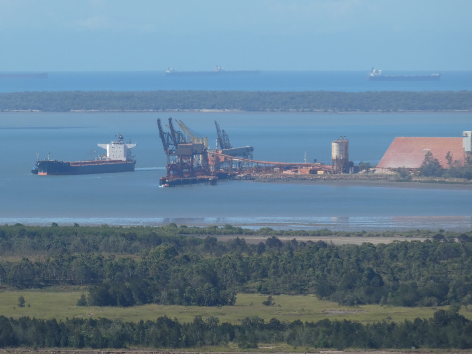
And, if you look closely at this photo, which from the elevated position I took it allowed us to peer over Facing Island out to the Coral Sea beyond (probably twenty kilometres distant), you will just be able to make out a number of bulk carriers lying in the roads awaiting their entry orders.
This rather hazy shot, taken later from a lookout at Tannum Sands, hopefully provides

some idea of the numbers of ships which use Gladstone. The ten pictured here were but half of the entire number of carriers spread out in the roads.

But for now it's back to Spinnaker Park where this imposing structure acknowledges the part played by the Gladstone Port Corporation in the development of the area. As would be expected, a fine cafe caters for park patrons who wish to partake of coffee and cake or enjoy a light luncheon.

Here too we found this interesting set of walls, built to honour the memory of one Reg Tanna. The redoubtable Reg held the position of General Manager of the Port Authority from 1966 until 2000. The plaque on the front wall reads, "A man whose pioneering spirit and vision were instrumental in developing the Port of Gladstone." Well done Reg!
So, with this acknowledgement of a local luminary, we took our leave of Spinnaker Park. We did later drive through the much larger Victoria Park but did not tarry. It is from here that various harbour and island tours depart, but despite our enforced extended stay, time did not allow us to indulge ourselves on this occasion. This may well form the basis for a future visit.
I have previously mentioned that the arrival of Queensland Alumina and the establishment of its huge refinery in 1963 was the springboard from which much industrial development followed. No commentary about the Port of Gladstone or local industry would be complete without mention of this most significant industry.
The alumina refinery is massive. It utterly dominates the landscape to the south-east of the city.

This all kicked off with the discovery of rich bauxite deposits near Weipa in 1955. An agreement was then struck between the mining companies involved and the Queensland Government to ensure that the bauxite was processed within State.
The lack of infrastructure in Cape region meant that area was unsuitable for the development of a processing plant. It finally fell to a choice between Brisbane and Gladstone. With its available land, the adjacent deep water harbour, rail infrastructure and its large power station, Gladstone became the obvious choice, and in 1963 work began.
By the end of 1966 the sprawling plant was completed, and on 11 March 1967 Queensland Alumina Limited began production. Further plant expansion followed and now this refinery is one of the largest in the world. Current annual production of alumina, the base product from which aluminium is made (this is quite a complex process......I'll not bore you with the details) stands at just shy of 4 million tonnes......and it gets better.....the product is the world's best smelter grade alumina.
What a success story this is. As you can imagine, with its 800 permanent employees and some 230 contractors, the flow on effect for the Gladstone community is significant. It is estimated that the present replacement value of this enterprise would amount to $4 billion, yep billion!
The refinery covers 80 hectares of a 3050 hectare site. Adjacent to the plant is a wharf and storage facility on South Trees Island, which is connected to the mainland by a causeway bridge as can be seen here in the excellent aerial shot taken from the company website.

And it doesn't end here. From the QAL lookout above the alumina refinery we could see out further to the south where the gleaming white paintwork of another massive plant stands in stark contrast to the connecting mangrove flats and the hills behind.

And it's all connected. This is the huge aluminium smelter at Boyne Island, about 20 kms from Gladstone itself, and again we are talking in superlatives. Boyne Smelters Limited (BSL) is the largest aluminium smelter in Australia. Its 1,100 employees produce over half a million tonnes of high quality ingot and billet.

The alumina produced at the Gladstone refinery is delivered by conveyor belt to the smelting plant which sprawls across the flat land just to the north of Tannum Sands (photo courtesy of the Boyne Smelters website)
Apart from the economic benefits this plant brings to the district, its development has had a major social impact. Significant infrastructure improvements to the Gladstone 'suburbs' of Boyne Island and Tannum Sands have been a direct result.
So, dear readers, as you can see, the aluminium industry in all its facets plays a central and highly important role in the Gladstone community. When we first arrived in this town last year we were struck by the obvious 'blue collar' appearance of much of the population at large. We are now far wiser.
Well, so much for my take on the parks and port of Gladstone....and I haven't even touched on the LNG plant which now features so dominantly at the opposite end of the harbour to the aluminium enterprises.
I still feel as though I've not been able to fully capture or adequately convey the extent of the marine enterprise we found here. I can but hope I've managed to now provide some measure of justification for my initial and ongoing comment about this town.....it is fascinating!

whilst below us, and further still to the right, is the unmistakable white gleam of the calcite stockpile and loading wharf.

Beyond this the grain silos and oil terminal cover the ground between this part of the port and Barney Point further yet to the right. Away in the distance the faint smudge on the horizon is smoke from the huge Queensland Alumina plant, but I'll have more to say about that later.
From the nearby James Cook Park I attempted a panoramic shot to bring all this together with, by my own admission, limited success. I should add the large building in the centre of the photo houses many staff of the large port authority.

One additional feature of this view, almost hidden behind a patch of bougainvillea mid shot, is the hull of HMAS Gladstone, a decommissioned patrol boat now preserved for posterity in the town which gave it its name. A closer look later.

Our next venture took us out along the roadway which took us past the northern boundary of the marina and on to the entry gateway of Spinnaker Park.

From here we drove further south along the eastern side of the park to a car park some distance from the entrance.

From here it was onto shanks' pony, along one of the several walking trails which circumvent this very well conceived and maintained public space.
This section of the path provided a wonderful perspective across Auckland Channel to the

bulk of Auckland Point and its lookout right at the tip, the Gladstone below, the docks of of the Esplanade Park, and on around to the high rise of the CBD.

From here too we were afforded another view of the calcite wharf with its backdrop of the towering grain silos

and a much better look at HMAS Gladstone in her permanent dry dock. And what a tale this is.
The Gladstone, a old Freemantle Class Australian Navy patrol boat, entered service in 1984. For the next twenty two years she served principally in northern Australian waters where she contributed to fisheries protection, customs and drug law enforcement and immigration operations.
This stalwart vessel sailed over almost 620,000 nautical miles before being decommissioned in March 2006. She was then stripped of all things which go bang in the night, and, as the result of extensive dogged lobbying by the town's civic leaders, sailed to Gladstone where she was gifted to the Gladstone Maritime History Society.
She lay at anchor in the port for several years until, in November 2014, she was finally moved to the defunct slipway of the Gladstone Ports Corporation where she is now open for inspection and serves as a major tourist attraction for the town. I would have loved to go aboard, but sadly she was not open during our visit to this area (and my travelling companion was less than overwhelmed with enthusiasm at the thought).....next time!

The walking path around Spinnaker Park then took us to the western side of this oddly shaped spit of land. Here the sweeping grounds of Victoria Park came into view

as did the marine clutter of the small boat harbour where private yachts and 'stinkies' jostle for room side by side along the finger wharves.

The northern end of the marina basin has a much more commercial focus. Here we find a plethora of boat repair facilities, ship's chandlers and the operating bases for vessels such as the Curtis Island ferries. One of that fleet was making its way out of the marina as I watched.

These are very handy little vessels, with their drop bow allowing for easy vehicle access. And as I later saw, they can carry a healthy payload.

These bright marine workhorses can be seen throughout the day plying the waters of Port Curtis.

The walking path along the western side of Spinnaker Park brought another surprise. Apart from the expected public BBQ's

and a novel public toilet block set into the side of this small rise like an ammunition bunker (this does raise some interesting if somewhat crude ideas about noise abatement and so on!!)

here, in what is more of less the middle of the parkland area, I came across this large freshwater lake

on the surface of which the massed flowers of the water lilies presented a real picture.

By now our ramble had brought us back to the eastern side of the park, a tad nearer the entrance gate, to a small sandy cove

which looks out over the harbour channel and the calcite dock. I have to say that as a potential spot for a refreshing dip this had limited appeal for us, but we were reliably informed it is very well used by the local populace, as are all other parts of all the parks we visited. They clearly form a vital part of the Gladstone public infrastructure. We had no difficulty understanding why.

This side of the park also offers direct views across to the coal loading wharf which can accommodate three large bulk carriers all patiently lying alongside as the huge loading gantries crawl back and forth spewing coal into the gaping maws of the open hatches....day and night...night and day.

Here too finger wharves are home to the fleet of port tugs, extraordinarily powerful and amazingly agile vessels, all of which can spin through 360 degrees on their own axis (as we first saw in Esperance a couple of years ago). It is a such a delight to watch these nimble craft dancing around the huge bulk carriers as they chivvy and cajole them to a position alongside the various wharves.
This is a very busy tug fleet. As I have previously noted the extent of activity here can be difficult to grasp because of the distance from one end of the working harbour to the other, but despite appearances the port of Gladstone is a hive of constant activity.

As this shot of the loading facility we had been viewing from Spinnaker Park so amply demonstrates (thanks to the Port of Gladstone website) coal is king, but it is not on its own.
The deposits from the huge Moura and Blackwater basin mines, which arrive in Gladstone in trains up to almost two kilometres long to be loaded and shipped overseas, do form the greatest part of the export activity, but there is much more going on at the same time.
For the statistically minded here are the facts. Gladstone is Queensland's largest multi-commodity port, is the largest coal export port in the Southern Hemisphere (this was a surprise given what we have seen in the West), and, in terms of coal export, ranks as the fourth largest in the world.
In addition to all this black stuff, aluminium, alumina, bauxite, cement products, calcite, liquid ammonia, and more recently LNG, all leave Australia through the Port of Gladstone. In fact this massive port handles over 30 different export commodities.

Armed with this knowledge, the sight of large ships of all shapes and sizes
constantly on the move through the harbour comes as no surprise.
And, if you look closely at this photo, which from the elevated position I took it allowed us to peer over Facing Island out to the Coral Sea beyond (probably twenty kilometres distant), you will just be able to make out a number of bulk carriers lying in the roads awaiting their entry orders.
This rather hazy shot, taken later from a lookout at Tannum Sands, hopefully provides

some idea of the numbers of ships which use Gladstone. The ten pictured here were but half of the entire number of carriers spread out in the roads.

But for now it's back to Spinnaker Park where this imposing structure acknowledges the part played by the Gladstone Port Corporation in the development of the area. As would be expected, a fine cafe caters for park patrons who wish to partake of coffee and cake or enjoy a light luncheon.

Here too we found this interesting set of walls, built to honour the memory of one Reg Tanna. The redoubtable Reg held the position of General Manager of the Port Authority from 1966 until 2000. The plaque on the front wall reads, "A man whose pioneering spirit and vision were instrumental in developing the Port of Gladstone." Well done Reg!
So, with this acknowledgement of a local luminary, we took our leave of Spinnaker Park. We did later drive through the much larger Victoria Park but did not tarry. It is from here that various harbour and island tours depart, but despite our enforced extended stay, time did not allow us to indulge ourselves on this occasion. This may well form the basis for a future visit.
I have previously mentioned that the arrival of Queensland Alumina and the establishment of its huge refinery in 1963 was the springboard from which much industrial development followed. No commentary about the Port of Gladstone or local industry would be complete without mention of this most significant industry.
The alumina refinery is massive. It utterly dominates the landscape to the south-east of the city.

This all kicked off with the discovery of rich bauxite deposits near Weipa in 1955. An agreement was then struck between the mining companies involved and the Queensland Government to ensure that the bauxite was processed within State.
The lack of infrastructure in Cape region meant that area was unsuitable for the development of a processing plant. It finally fell to a choice between Brisbane and Gladstone. With its available land, the adjacent deep water harbour, rail infrastructure and its large power station, Gladstone became the obvious choice, and in 1963 work began.
By the end of 1966 the sprawling plant was completed, and on 11 March 1967 Queensland Alumina Limited began production. Further plant expansion followed and now this refinery is one of the largest in the world. Current annual production of alumina, the base product from which aluminium is made (this is quite a complex process......I'll not bore you with the details) stands at just shy of 4 million tonnes......and it gets better.....the product is the world's best smelter grade alumina.
What a success story this is. As you can imagine, with its 800 permanent employees and some 230 contractors, the flow on effect for the Gladstone community is significant. It is estimated that the present replacement value of this enterprise would amount to $4 billion, yep billion!
The refinery covers 80 hectares of a 3050 hectare site. Adjacent to the plant is a wharf and storage facility on South Trees Island, which is connected to the mainland by a causeway bridge as can be seen here in the excellent aerial shot taken from the company website.


And it's all connected. This is the huge aluminium smelter at Boyne Island, about 20 kms from Gladstone itself, and again we are talking in superlatives. Boyne Smelters Limited (BSL) is the largest aluminium smelter in Australia. Its 1,100 employees produce over half a million tonnes of high quality ingot and billet.

The alumina produced at the Gladstone refinery is delivered by conveyor belt to the smelting plant which sprawls across the flat land just to the north of Tannum Sands (photo courtesy of the Boyne Smelters website)
Apart from the economic benefits this plant brings to the district, its development has had a major social impact. Significant infrastructure improvements to the Gladstone 'suburbs' of Boyne Island and Tannum Sands have been a direct result.
So, dear readers, as you can see, the aluminium industry in all its facets plays a central and highly important role in the Gladstone community. When we first arrived in this town last year we were struck by the obvious 'blue collar' appearance of much of the population at large. We are now far wiser.
Well, so much for my take on the parks and port of Gladstone....and I haven't even touched on the LNG plant which now features so dominantly at the opposite end of the harbour to the aluminium enterprises.
I still feel as though I've not been able to fully capture or adequately convey the extent of the marine enterprise we found here. I can but hope I've managed to now provide some measure of justification for my initial and ongoing comment about this town.....it is fascinating!
No comments:
Post a Comment