Amongst the advertised attractions of Poona, swimming and fishing rate very highly. To enjoy the former I foolishly expected that there would be a fine sandy beach (particularly given that the town lies on the end of 'The Great Sandy Straits') on which to lounge between refreshing dips in the briny.
The first thing we learnt is that the waters of the straights between the mainland and Fraser Island are tidal.....seriously tidal. There is sand of sorts....rather course and grey, but as with many Queensland 'beaches', this is limited to a rather thin strip above the high tide mark.

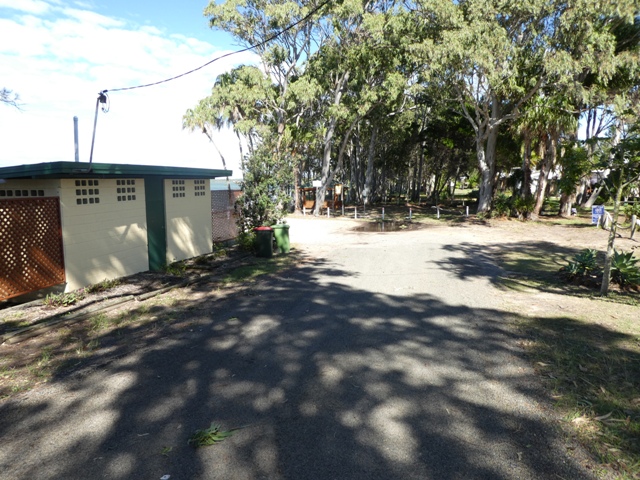
Let's take a look. Our park is but a short walk from the entrance to the local boat ramp at the end of the street.

At high tide, the prospects seem reasonably promising as we look north along the water's edge late in the afternoon

and in the other direction.

But what a difference a few hours can make as the tug of the moon exerts its influence over the ocean

and the waters recede for a very long way to reveal grounded boats and broad, muddy tidal flats.
And the signs prominently posted near the boat ramp do not encourage a romp in the water. Here it is not crocs and stingers which lie in wait for an unwary bather, it is stone fish. These tropical menaces lie on the ocean floor ready to pierce the unprotected feet of the foolish with their sharp spines and inflict a wretchedly painful sting. Study footwear is highly recommended for any venturing out into the water. Great! But many do wade out onto the exposed flats, and indeed had it not been for the wrath of the weather gods I was ready to do the same when the heavens opened and the winds howled, as you have seen.

Pumping live 'nippers' or 'yabbies' (depending on where one comes from) for bait is a favoured pastime at low tide,

and at least one of our fellow park inhabitants was want to wander across the mud to the far side of the inlet to try his luck in the various channels left by the receding waters.

It can be quite a hike.....let's give this some perspective (and even this is something of a close-up!). But did he have success?....I'm afraid not. As he told me rather ruefully, he was half asleep as his baited hook was hit by a really good tug, but the hook was not set.....a large flathead still roams the waters off Poona and his treks across the flats were to no avail.
A number of other angling hopefuls who had lined the water's edge on the high tides reported equally poor success. So I wasn't overly distressed by the fact that when I was ready have a crack the weather was prohibitive.

Needless to say, the many boaties who use this ramp to go fishing or to set and retrieve their mud crab pots, have to navigate these waters with care. These rather odd little lateral markers show the way through the deeper channels.
I was initially somewhat confounded by how small they are (compared to normal port and starboard lateral channel markers) until it was pointed out that the constantly shifting sands mean that they are equally constantly having to be moved. Anything too permanent would not allow this to be done with ease....'local horses for local courses' indeed!

Despite the challenges of this marine environment, the area does have its appeal. A ramble along the local walking track, which begins at the boat ramp, presented us with all sorts of interesting sights.

Initially the track took us through quite open spaces across that we thought at first were home owners' back lawns. We soon learnt that although many take advantage of theses areas for their own benefit, it is public land for all to use.

As with all good walking trails, informative signs are dotted along it to provide information about the local flora and fauna.

As I mentioned previously, many who have their holiday homes along this stretch of the coast, or live here permanently, have taken advantage of the fact that they can virtually do as they please in the public land area at the back of their houses. This 'private' boat launching track is but one example.

The wide, open expanses which abut the rear fences of the houses at the beginning of the track

soon give way to a more closed environment where white marker posts kept us on the straight and narrow through the trees.

Just as the nature of the trail changed as we walked along it, so too did the standard of the local housing. Many at the beginning were modest to say the least, but this was not the case further on as you will shortly see.

In many places the track took us quite close to the water

where, along certain stretches, there was clear evidence of much more structured pathway, now well past its former grandeur.

Coastal debris is a constant feature of this area. The stark bleached roots of this fallen palm are a reminder that although this region is below the recognised regular cyclone zone, the winds here can often be less than benign.

Another feature of this part of the world is the ubiquitous mangrove, both grey and red. They line the shore with their mats of breather roots,

and demonstrate their extraordinary tenacity by taking root well out into the water where the high tide almost covers them.

Midway along the length of this walk the trail moves onto open ground once more for a short distance

before almost disappearing under the archways of quite dense tropical foliage.

At several points along the way, bright red hibiscus flowers stood out against the green backdrop

and little yellow natives did their best to brighten the scene.

As I mentioned previously, many who live here take advantage of the fact that there do not seem to be any restrictions on what they do on the public land at the back of their houses. At many spots we saw that benches had been placed to take advantage of the views out over the Straits.

The style of these was as varied as the housing. Simple benches for two were more than enough for some,

whilst others obviously partied on the water's edge in greater numbers, either very casually

or, as in this case, on a more formal outdoor setting. But no matter the style of seating, the low hump of Fraser Island across the water was a constant.

At the northern end of the path, the housing is much more up-market than in other sections. And again, like the outdoor furniture, styles varied. Some modern homes

can be found side by side with a few beautiful more traditional 'Queenslanders' with their stairways and wooden lattice work.

The trail ends at a small park complete with public loos and a picnic area, put here to cater for those

who wish to spend a day at the 'beach'. What a far cry this is from the wide sand expanses of the metropolitan Adelaide coastline!
Irrespective of the paucity of sand, this is a fascinating waterway, one which has obviously attracted many to live here both on a full time basis and as holiday makers. And again, as we have found elsewhere, a good walk around the relatively small town of Poona revealed some very interesting sights.

before almost disappearing under the archways of quite dense tropical foliage.

At several points along the way, bright red hibiscus flowers stood out against the green backdrop

and little yellow natives did their best to brighten the scene.

As I mentioned previously, many who live here take advantage of the fact that there do not seem to be any restrictions on what they do on the public land at the back of their houses. At many spots we saw that benches had been placed to take advantage of the views out over the Straits.

The style of these was as varied as the housing. Simple benches for two were more than enough for some,

whilst others obviously partied on the water's edge in greater numbers, either very casually

or, as in this case, on a more formal outdoor setting. But no matter the style of seating, the low hump of Fraser Island across the water was a constant.

At the northern end of the path, the housing is much more up-market than in other sections. And again, like the outdoor furniture, styles varied. Some modern homes

can be found side by side with a few beautiful more traditional 'Queenslanders' with their stairways and wooden lattice work.
The trail ends at a small park complete with public loos and a picnic area, put here to cater for those

who wish to spend a day at the 'beach'. What a far cry this is from the wide sand expanses of the metropolitan Adelaide coastline!
Irrespective of the paucity of sand, this is a fascinating waterway, one which has obviously attracted many to live here both on a full time basis and as holiday makers. And again, as we have found elsewhere, a good walk around the relatively small town of Poona revealed some very interesting sights.
No comments:
Post a Comment