Tomorrow was cruise day, our one and only venture out onto Macquarie Harbour and beyond. We went to bed praying.....for a fine day.
With the dawn we arose to find that the the weather gods had blessed us. Our somewhat anxious wait was over. The sun beamed down out of a clear sky on a perfectly still morning, and as we had now come to realise, on the west coast of Tasmania that's as good as winning the lottery!
I was particularly relieved. As the team weatherman, it had fallen on me to make a prediction and pick the day of our booking (which of course I claimed had caused me no anxiety whatsoever....I suspect 'she' knew differently!).
Apart from choosing the day, we also had two more decisions to make......which tour to take and what seating would suit us. Two cruise boats operate out of Strahan, both providing virtually identical tours. We learnt that one was operated by a multi-national group (the White Boat) and the other by a local family business (the Red Boat). This was a no-brainer.....it was the Red Boat of 'World Heritage Cruises' for us.
The seating choice was not quite so straightforward. Upper deck?.. window?...or a pot luck seat in the middle of the boat? After some debate, the window seats won out. The booking was made, the fee of $145 each was paid, and we were committed......the weather watch began!
But as I have told you, we cracked it. We departed bright and early for the 37 kms trip to Strahan in high spirits. As we climbed out of Queenstown we had a few uneasy moments as we were enveloped in a light morning mist, but by the time we had eased down into Strahan, that had all cleared.

The still waters of the Strahan harbour were sparkling under a clear, bright sky. "No need for the seasickness pills, Lizzie". She took them anyway!
At this point I have and admission to make.....our plans to return to Strahan and walk the town did not come to fruition, so I've included a few shots from the Internet and a couple we took from the Cruiser later. The fact of the matter is that 'tourist Strahan' is almost entirely located along the dock area and around the harbour to Regatta Point opposite.
This is where the majority of the hotels, guest houses and other short term holiday accommodation is to be found, and for good reason....the views. We did take a quick look at the beach front caravan parks a short distance from the harbour, and at some of the 'back blocks' of town whilst coming and going, and I have to say that our decision to base at Queenstown for the duration rather than haul the van across here for a few days was more than justified in our minds.
But having said that, the harbour area of Strahan is just lovely, as this shot taken from a hotel

balcony above the water and brought to you courtesy of 'spiritland' shows. Here you can see the Red and White boats sharing the docking facilities with a couple of craft from the local fishing fleet. The lawn area runs right around the end of the bay, and it is quite easy to walk around to the other side of this part of the beautiful Macquarie Harbour.

Hamers Hotel, with its long upper balcony, takes up a fair proportion of the streetscape opposite the wharf

and unsurprisingly there are a number of cafes and restaurants dotted along this section of the 'esplanade'.

Most of these cottages at the end of the harbour are given over to holiday accommodation.

I'm not quite sure about the large buildings just beyond the pub, other than to say they are definitely part of old Strahan, and certainly do much for the visual amenity of this part of town.

 At the far end of the dock area, this old building certainly speaks of the times when this was a much busier port, one which serviced Queenstown before the road connection was made in the 1930's, and through which most of the goods and supplies were landed for nearby Zeehan during its boom times.
On the other side of the bay the old railway station and other infrastructure of Regatta Point can be clearly seen. The entire area around the point and along the road around the water, is dotted with holiday homes and tourist accommodation.

But we were here for the cruise. The 'Harbour Master' awaited our boarding.

A little unsure of the travelling time across the ranges, we had arrived in plenty of time and were amongst the first to board. This gave me the chance to take an uncluttered shot of the forward section lower deck seating

and back past the food servery towards the large and well stocked bar as Liz made herself at home in our two allocated window seats.
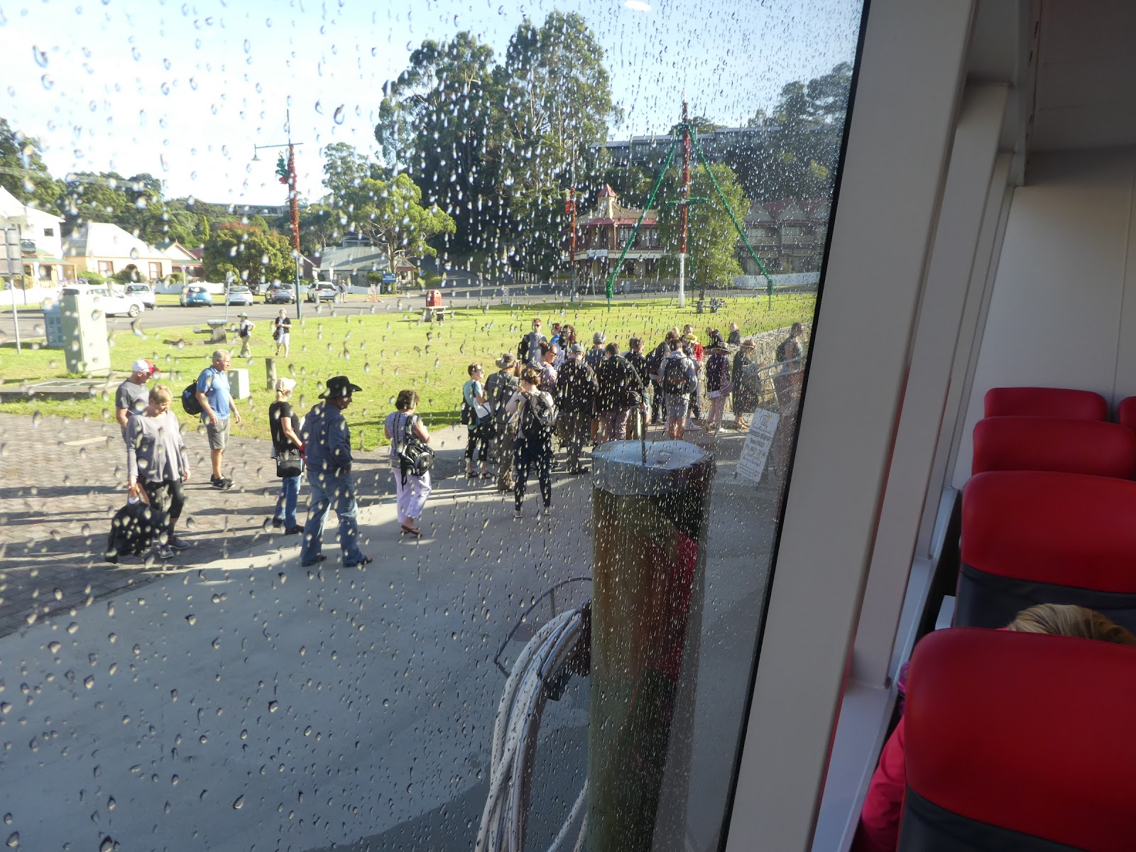

The windows were sprayed clean of salt, and the crowds were gathering dockside.
As the seats filled with those on our cruise,

the White boat made out into the harbour well ahead of our departure. The cruises run by both companies are exactly the same and given that the docking facilities at Sarah Island and the Heritage Walk site on the Gordon River are shared, a staggered visiting schedule is mandatory.

Whilst we waited I took the opportunity to snap this smart little cray boat alongside in our basin, its foredeck strewn with the wicker pots which are so popular with the fishermen here.

And then, finally, the deck vibrated beneath our feet as the boat's engines roared into life and we eased gently away from the dock.

As we got under way, we had a view of another section of the Strahan fishing fleet, tucked up here at the far end of the bay beneath the heavily timbered hills just ever so lightly misted with an early haze.
Beyond the tourist hub of the wharf area, we passed the 'working end' of this section of the

harbour, where more craft of the significant local fishing fleet were moored or up on the slips.

Tourism plays a significant part in Strahan's economy, and the town is certainly geared for it. Those with the wherewith all and a penchant for an aerial view of the magnificent Macquarie Harbour and beyond are well catered for.

As the glassy calm waters of the harbour opened before us beyond Regatta Point,

the skipper hit the throttles. We were off and running, but to where?
This World Heritage Cruises route map provides the answer. As you can see, Macquarie

And what a setting, as we were about to see as we made our way out firstly to the extraordinarily narrow entrance at Hells Gates, thence back past the salmon farms (controversial), took a grand tour of Sarah Island and then finally cruised up into the Gordon River.

The dash out to Hells Gates took us past a stretch of these long rock walls which extend quite a distance into the harbour from the entrance.
They have been built for a very good reason. The tiny harbour entrance creates more than just a problem of through passage. It also means that the tidal flow is negligible. These long walls, similar to 'training spurs' we had seen on the River Murray, direct the incoming and outgoing tides along a long, narrow channel, one which is kept clear of any silt build up by this constant and very restricted flow. Natty!

As we neared the entrance, we could see across to one of the long beaches which are a feature of the Macquarie Heads, where one group was trying their luck fishing off the beach.
Looking at the entrance as we approached, it was easy to see why so many mariners came

to grief here in the days of yore. Despite the apparent width of harbour mouth, the only section which is navigable is the tiny gap between the headland the rocky outcrop which is Bonnet Island. To the other side of Bonnet, the surf of the Southern Ocean rolls and crashes across sandy shoals and flats, even on a day as benign as this was.

All vessels entering or leaving Macquarie Harbour have to thread this watery needle,


and as we made passage through the gap, the foam of our wake gave us a good idea of just how narrow it was,
an impression which was highlighted even more as this small fishing boat came out behind us.

We cruised a short distance out to sea, from where we could look back at the entrance through which we had just sailed

before going about and approaching the Bonnet Island light

and the rocky headland bluff from the opposite direction.

Once we had eased through the gap, the skipper again increased power and our boat lifted her skirts as we headed

back past the few houses on the headland

and another section of the rock wall, which was becoming more exposed by the minute as the tide dropped.

We were off now to visit the salmon pens, a commercial venture which has been the subject of much recent controversy.
You may recall I went into some detail about this when we had visited the Huon Salmon outlet on The Channel some weeks ago. I'll not bore you with a repetition other than to say that, at the time we were here on the harbour, the relevant Court case brought by the Bender family relating to their allegations that overcrowding was unsustainable and ecologically dangerous, was still progressing.

I came across this chart which shows the extent of the salmon farm leases in the harbour and have to comment that they do cover a significant area.

We cruised on up to this group of pens

where a tender boat was spraying feed into one of them and hove to for a while whilst the skipper gave us what I though was a somewhat skewed spiel about the value of the industry to the State and to Strahan in particular. Oddly enough no mention was made about the legal fracas which was swirling around the venture here.

Now I ask you, does this not look just idyllic? A small island sitting serenely in the calm waters of this huge harbour. How looks can be so deceiving. We were on approach to the infamous Sarah Island, at one time the most brutal convict settlement in Australia.
And this is as good a time as any to briefly return to the harbour entrance and its name. Until this visit I had always through that 'Hells Gates' was a reference to the challenges of through passage and the maritime grief wrought here.
Not so, dear readers. The name arose during the convict era here, when those transported to Sarah Island were of the view that they were going to hell on earth......hence the name given to the harbour entrance.

With our trusty vessel duly secured to the mooring pylons of the small landing dock,

we trooped ashore. This was the stop to which I had been most looking forward.

As this shot from 'Discover Tasmania' shows, Sarah Island is not large
but I found it absolutely fascinating. I could have easily filled two blogs with the history and various stories about this once utterly evil place, but I shall remain true to my new resolve and refrain from doing so.

There is not much left of what was once a quite complex infrastructure here on Sarah Island during it heyday. Here and there you can spy mounds of old bricks and

and remnants of buildings as you follow the walkways past the various significant sites.
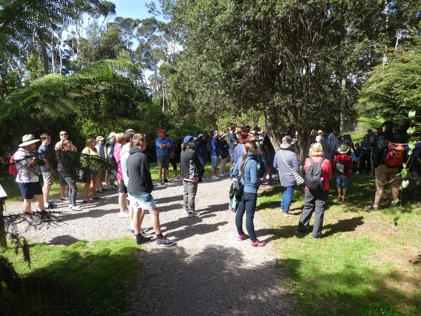
It was here that the tour company shone. Rather than leave us all to our own devices, (which we oft prefer but which would not have been practical here given our time constraints) our touring party was divided into two groups.
Each was then led by a 'crew member', who was actually a local amateur thespian. They took us from one significant site to the next. At each stop these consummately skilled story tellers regaled us with tales of the past, the history of the rise and fall of Sarah Island and the lives of many who had lived and slaved here. It was brilliantly done....and that coming from the world's leading tourist group sceptic!
Before we wander further, this article from 'The Examiner' 29 September 2016, provides a concise and well coloured history of this dreadful place.
"Sarah Island in Tasmania's south west wilderness is remembered as a place of degradation, depravity and woe. So wrote the Tasmanian historian John West in 1842.
Sarah Island was Tasmania's earliest penal settlement, having been established in January 1822, and was intended to strike fear into the hearts of convicts.
Unlike Port Arthur, where the aim was to rehabilitate lost souls, Sarah Island was intended as raw punishment reserved for the worst of convicts [entering through Hells Gates!].
The use of strict discipline and constant hard labour made it a place to be feared. Even more brutal, convicts were often chained to rocks on the considerably smaller nearby Grommet Rock that was washed in sea spray in bad weather.
For many men the burdens of Sarah Island were intolerable. During the early phase of the settlement, some deliberately committed murder in order to be sent to the gallows and escape once and for all from the tortured lives they led.
Despite the brutality, the island was also a successful centre of industry. Pining [the name given to the harvesting of Huon pine] along the Gordon River and shipbuilding were among the trades carried out by the convicts and in its day, Sarah Island was the largest shipbuilding yard in Australia.
Although not as well-preserved as Port Arthur, the significance of what is still evident is no less historically important. Remnants of the penitentiary, bakehouse and solitary cells can still evoke images of this island's notorious convict past.
The Sarah Island penal settlement was closed in 1833 after the establishment of the penitentiary at Port Arthur."

This was another typical example of the 'remnants' to which reference was made and which we saw during our stay.

Some, like these old ovens, were easy to distinguish,

but many of the ruins were little more than small sections of old walls.
But with each came a story, such as this which related to the ruins of the bakery we were looking at.


As well as taking us past all the significant historical sites, our route around the island provided some delightful views across the calm waters of the harbour.
At various spots along the walkways, information boards such as this told of varying activities which took place here

and of those who were responsible.

Amidst all the brutality, some of the feats of industry here on Sarah Island were nothing short of extraordinary. Take the land reclamation project, for example.

Appointed as the Commandant of the Macquarie Harbour penal settlement in 1825, Captain James Butler of the British 40th Regiment, set to with a will to make the most of Sarah Island, consistent with the notion that it must always remain a place to be feared by the convicts.
In what was clearly a first for this new country, one of his more remarkable projects was that to reclaim much of the waterfront. Using the large labour force at his disposal, he devised a system of logs and fill which raised the level of the land above the water line. On this he then built much of the island infrastructure, including that needed for ship building.....another story.
This drawing, held in the State Library of NSW, provides an impression of the results of

Butler's vision and the convicts hard work.

Some of the logs which formed the foundations of the reclaimed land area can still be seen today, another example of the enduring quality of Huon pine.

One of the largest sections of preserved walls are those which formed part of the island gaol......how apt!
But eventually, under what can only be described as the unusually (for the day) enlightened, energetic and highly organised command of the redoubtable Captain Butler, life here on Sarah Island was dramatically transformed.

With the assistance and skills of David Hoy, by the late 1820's Sarah Island had become the site of the largest shipbuilding yard in Australia.

One can only marvel at the transformation of men like James Reeves, for example, and reflect on the foresight and basic humanity of Butler and Hoy, men of vision, integrity and skill who brought such a positive change to life here on the island beyond Hells Gates.
Our departure was imminent, but we had one last mystery to challenge us.

Just what were these ruins,

perched high on the bluff overlooking the water?
No-one quite knows....to this day!

How fitting it was, I thought, that we should depart this island of extremes on this note of mystery. What an absolutely absorbing place this was, and how well its history was presented to us. I should add here that the two blokes who did the presentations during our Sarah Island jaunt also act out an historical play at their little theatre in Strahan on a nightly basis during 'the season'. Needless to say a spot of advertising was inevitable!
As promised, I've resisted waxing lyrical and at length about much of what went on here. The stories of the escapee Alexander Pearce and his cannibalism, for example, make for chilling reading. And there are so many more. I'll leave it all up to you, dear readers.

And now it was time to rejoin our waiting boat. The lunch bell was about to sound.


Whilst we had been roaming Sarah Island, the on board crew had been busy.
The long buffet counter was laden with cold meats, cheeses, and fruits.

The salad bar was equally adorned.

I had decided to have a 'dry' day, but Liz had no intention of disappointing the bar staff with a non-appearance.

Cheers!
.
This was a buffet luncheon to write home about. After the first frenetic feeding frenzy along the food bar, and all the human gannets (it's inevitable that there will be some in groups like this) had settled back in their seats, more and more platters were brought out. I had been politely circumspect in my first foray, but now the gloves were off.


As we took our last look at the 'mystery' ruins,
.
and watched a group of kayakers enjoying a paddle on the serene waters of the harbour (one of whom was much smarter than his companions...no wonder he was in front!)
the crew made it very clear that nothing was to be left on the buffet platters. Ever the polite guest, who was I to refuse? I took full advantage of this largess. This was a luncheon to be remembered and a real credit to the folk of 'World Heritage Cruises'.

We were still munching as we finally entered the famous Gordon River,

where the deep cold waters of this well know waterway flow past densely timbered banks.

Our run up the Gordon to the heritage landing was not long, and as we made our way through a few of the river bends I could not help but reflect on the almost impossible task of bashing through this dense bush as some escaping Sarah Island had done. And then there were the 'piners' ......what a place this is and what a hardy lot they were.

Scenically striking as it may be on the water, the Gordon from the air is nothing sort of spectacular as is evidenced by this shot included courtesy of 'laurie ford images'

and this from 'viator'.

Some 12 miles or so upstream brought us to the landing where a well constructed walkway provided access to the forests on the bank.

Here again, those who wished to do so gathered whilst a crew member presented a wide ranging and very well informed talk about the various timers of this forest region, pointing out Huon pine, leatherwood, sassafras and other important species.

We stuck it out for a while, but soon discovered we already knew most of what he was speaking about, so we took off on a jaunt through the bush, to again be reminded of just how thickly this cool climate rain forest grows

I could not let pass the opportunity to photograph one specimen of that most incredible of timbers, the Huon,

before my attention was drawn to another example of what can be seen often in these environments,

fungi of almost limitless varieties of shapes and sizes.

After a sojourn here of some thirty minutes or so, we were recalled on board for the return trip,

during which I was amazed to see odd little riverside landings


at various spots along the way.
The question for me was, how on earth did they get there? I could only assume the materials were brought upstream by boat. The bush beyond the banks was an all but an impenetrable jungle. One thing was certain, though......once here and rafted up, isolation would be assured.

On this leg of the trip passengers were invited to join the skipper on the bridge if that was their fancy. It was certainly mine.

Once the initial crowd thinned a little I was able to get a good look at the chart plotters, the various engine instruments

and watch as his nibs navigated with the use of the tiny little joystick you can see here centre shot.

By the time we had left the river and sailed on out into Macquarie Harbour once again, the afternoon breeze was beginning to ruffle the surface. The mirror like calm of the morning was a thing of the past for today, but these ripples did nothing to disturb the smooth passage of our big Red boat.

The jagged ridges of the mountains were a hazy blue in the distance as we steamed steadfastly on

until the Strahan docks were again immediately ahead of us. In short order we were alongside and securely moored.
This had been a truly wonderful day. Perfect weather, impressive scenery, a very comfortable cruise boat, a most excellent luncheon, and a first class commentary which made sense of everything we were shown. Hells Gates and Sarah Island had both been high on my bucket list.....they were now ticked off.
No comments:
Post a Comment